|
©The Archaeological Settlements of Turkey - TAY Project
|
|
|
|
|
|
Keraitai |
|
|
For site maps and drawings please click on the picture... 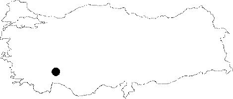 |
For photographs please click on the photo...  |
|
Type:
|
City |
|
Altitude:
|
m |
|
Region:
|
Mediterranean |
|
Province:
|
Burdur |
|
District:
|
Bucak |
|
Village:
|
Belören |
|
Investigation Method:
|
Survey |
|
Period:
|
Hellenistic Roman Classical |
|
|
|
 |
|
| Location: It was founded on the eastern slope of a steep hill known as Cere Asari or Sivri Tepe near Beloren; 8 km north of the Bucak District of the Burdur Province. |
| Geography and Environment: It is located 1000 m high on a hill surrounded by pine and juniper trees; overlooking the entire area. |
| History: The city was built during the Hellenistic Period. The coinage is dated to the 1st century BC. She minted homonoia coins with Cremna [Head 1911:590]. The arable western part of the city lands might have been incorporated to Sagalassos during the Augustus Period. Following the foundation of the colony at Cremna; Ceraitae lost its political power; becoming a village connected to Cremna [Waelkens et al. 1997a:14; 54]. Ceraitae is also identified with the city of Cretopolis; which might have been founded on an accessible site in the Bucak Plain. |
| Research and Excavation: The researches in the ancient city were carried out by K. Dortluk on behalf of the Antalya Museum in 1972. A survey was conducted by S. Mitchell and I. Guceren in 1994. The recent researches have been conducted by a team under the direction of M. Waelkens on behalf of the Catholic University of Leuven. It was visited during the survey conducted by H. Metin and his team in 2013 [Metin et al. 2015]. |
| Stratigraphy: |
| Small Finds: |
| Remains: City wall: The city wall dating to the Hellenistic Period enclose the city to the east; north and south. The western slope was not fortified as it was steep enough. The survey conducted by H. Metin in 2013 shows that the city walls were built in dry wall technique. The spaces between stones were filled with smaller stones. The city wall was built with polygonal stones and the bedrock was benefited in some parts of the city wall. There is no bastion or tower on the city wall. The thickness of north wall is 1.80 m; while the east wall is 1.50 in thickness [Metin et al. 2015:326]. Bouleuterion: It is from the Late Hellenistic Period and it is the biggest structure survived to today. The steps were carved into the rock to the east of the hill. It was built with dressed blocks. Cistern: Many cisterns dating from the Late Hellenistic Period were found during the resarches. During the survey conducted by H. Metin in 2013, 6 wells and a cistern were discovered. It was suggested that these cisterns were used for storing water coming from the western skirts of Sivri Tepe. The fountain located in the area outside the city wall in the northeast of the city bears an armored soldier relief. The sloping area located to the east of this fountain might have been used as theatre [Metin et al. 2015:327]. Building with unknown function: 20 m below the bouleuterion are monumental buildings; among which exists a stoa of 23.6x12 m with a "L" shape in Doric order. Necropolis/grave: The necropolis is located on the western slope of the hill; consisting of sarcophagi. The heroon on the slope was erected for Aurelianus Nester and his wife; Aphrania. Miscellaneous: The paved part of the ancient road between Cremna and Sagalassos passes through the ancient city. Potsherds from the Classical; Hellenistic; Roman and Late Roman Periods were unearthed. |
| Interpretation and Dating: |