|
©The Archaeological Settlements of Turkey - TAY Project
|
|
|
|
|
|
Cin Tepe |
|
|
For site maps and drawings please click on the picture...  |
For photographs please click on the photo... 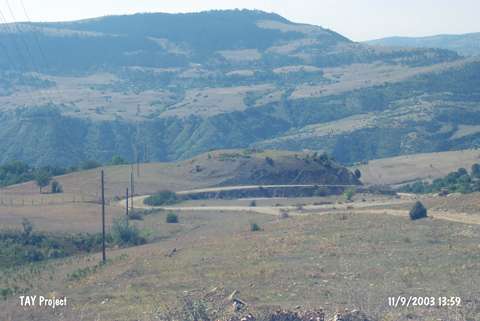 |
|
Type:
|
Mound |
|
Altitude:
|
950 m |
|
Region:
|
Black Sea |
|
Province:
|
Sinop |
|
District:
|
Gerze |
|
Village:
|
Sarimsak |
|
Investigation Method:
|
Survey |
|
Period:
|
|
|
|
|
 |
|
| It lies 200 m southwest of Sarimsak Village; some 20 km south of Gerze District. It is to the northeast of Sarimsakli Stream; north-northeast of the road between Sarimsakli and Tilkilik villages; and north of the forested area known as Egrelti Alti. It was discovered during the Sinop Survey conducted by M.A. Isin. It measures 7 m in height and 80 m in diameter. It has been damaged due to illicit digging. Pottery belonging to the Chalcolithic Age; the EBA and the Roman Period was collected from the surface. EBA pottery is of grit; plant and seashell tempered and burnished ware. Surface colors vary from buff to brown. Forms of dishes and jugs were recovered. It takes place in the registered archaeological sites list prepared by Ministry of Culture and Tourism. |
| Location: |
| Geography and Environment: |
| History: |
| Research and Excavation: |
| Stratigraphy: |
| Small Finds: |
| Remains: |
| Interpretation and Dating: |