|
©The Archaeological Settlements of Turkey - TAY Project
|
|
|
|
|
|
Apameia Kibotos |
|
|
For site maps and drawings please click on the picture... 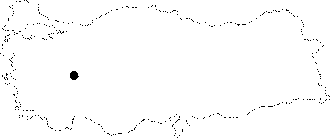 |
For photographs please click on the photo...  |
|
Type:
|
City |
|
Altitude:
|
m |
|
Region:
|
Aegean |
|
Province:
|
Afyonkarahisar |
|
District:
|
Dinar |
|
Village:
|
Merkez |
|
Investigation Method:
|
Excavation |
|
Period:
|
Hellenistic Roman Archaic Geometric Classical Orientalizing Protogeometric |
|
|
|
 |
|
| Location: It has been obscured by the Dinar District on the Afyonkarahisar-Aydin motorway; 100 km southwest of the Afyonkarahisar Province. |
| Geography and Environment: Apamea Cibotus; located at the beginning of the Meandros Valley; has been bordered by Apollonia Mordiaion to the east [Topbas 1991:309] |
| History: Apamea Cibotus (Apameia Kibotos); also referred as Apameia ad Maeandrum; was built as successor to the ancient city of Celaenae (Kelainai) by Antiochus Soter [Strabon 12; 8; 15]. The new city was named Apama after the mother of king; wife of Seleucus Nicator. The city was incorporated into the Province of Asia by Proconsul C. Fannius in 49 BC. It became a conventus (governmental district) ruled by a governor during the Roman Period. Among the well known coinage are silver cistophorus and bronze coins; which were minted between 189 and 133 BC. Also available are alliance coins with Ephesus. She minted semi-autonomous coinage in the name of the emperor during the Roman Period. She had a strategical significance as it was located at the junction of major routes. It was the second big trade center in Asia Minor after Ephesus. The goods from Italy and Greece had been stored in this center [Strabo 12; 8; 15]. It was included within the borders of the Province of Pisidia after 297 AD. |
| Research and Excavation: Salvage excavations were conducted under the direction of of A. Topbas on behalf of the Afyon Museum between 1986 and 1989. And; a survey was conducted by M. Ballance in 1994. A throughout survey was conducted by Üyümez et al. in 2008. The goal of the survey was to identify the locations of Kelainai and Apameia-Kibotos cities and the locations of the main building structures; to find out whether Kelainai and Apameia-Kibotos were two cities built adjacent to each other or the name of the old city was changed; and in addition identifying the economical and cultural liaisons of the city through surface finds [Üyümez et al. 2010:37]. |
| Stratigraphy: |
| Small Finds: |
| Remains: Theater: It was built on a natural rock on the slope of the Uclerce Hill facing west to the northwest of Dinar. The hill was also acropolis of Celaenae. The cavea of the theater faces the Plain of Dinar. The stage building is in the east-west direction; with a similar structure to those of Arycandus and Priene. The parodos and exodos walls of the theater have been partially uncovered during excavations. The embossed walls rising inclined to the outer corners resemble the theaters of Alinda; Alabanda and Priene. Some coins from the Hellenistic Period and potsherds from the Protogeometrical to Roman Periods were uncovered inside the theater. It seems that it underwent restorations during the Hellenistic and Roman Periods. Stadium: The remains of the stadium are traceable along the Dinar Su valley on the edge of the main road. The end of the structure is yet to be identified. The southeastern part was built by engraving the slope; and the rest must have been supported by a substructure. The rows of seats; at least about 12; are of white limestone. It is dated to the Hellenistic Period. Six steps were unearthed during the cleansing performed as part of the survey by Üyümez et al. in 2008. The seatings in the ends of the steps contain lion legs at the bottom. Although the west side was obstructed by modern buildings, that end is unidentified but based on electromagnetic studies this section is near the sphendone [Üyümez et al. 2010:45]. Bath: The apsed structure to the northwest is presumably a Roman bath. The walls were built in double order; the inner surface being covered with marble tiles. Necropolis/Grave: A structure carved into the bedrock to the west of the theater; presumably a grave; was unearthed. It consists of a two-step dromos and a chamber in the east direction. Also found on the same slope are grave chambers carved into the rock and basin graves to the east and west of the theater. During the survey performed by Üyümez et al. in 2008 many rock graves were observed across from the hospital construction west of Karabayir hill which is south of Apameia. The presence of these rock graves is more intense near the vocational high school. These usually consist of two rooms and were partially built inside the rock and partially masoned using cut stones. Necropolis area spreads over the hill. Besides, there are graves in the area named Kaleyikigi on the other side of the railroad. The hill is covered by some tumuli in addition to the rock graves. Necropolis area is approximately 1500x1000 m and it extends north on Içlarca hill, then covers the Kapikaya and Kanlikaya hills. There are phallos type of tombstones and ossuarium in the area on Kapikaya hill. Another necropolis was identified on Tavsan hill which is 1.2-1.9 km from Içlarca hill. This necropolis is 1000x850 m and contains an 8 m high tumulus on a hill in the east. The tumulus is the largest graveyard identified near Apameia. The cemetery on Tavsan hill consists of rock grave rooms, large sarcophagi and tumuli as in the other necropoli at Apameia [Üyümez et al. 2010:41-42]. Besides these another necropolis was found between Dikici and Bülüçalani. This area measures 200x180 m and contains a 5 m high tumulus among the graves [Üyümez et al. 2010:43]. |
| Interpretation and Dating: The graves consisting of two chambers, which were partially carved inside the rock and partially masoned using cut stones found by Üyümez et al. in 2008 in the west of Karabayir hill, are assumed to belong to Hellenistic period due to these characteristics [Üyümez et al. 2010:41]. The sherds found during the survey performed on the Içlarca hill north of Dinar suggest that there is a settlement here at least since 2nd Millenium BC. This points out at the fact that the Hellenistic city was not built on previously uninhabited land, but on the remains of Kelainai city [Üyümez et al. 2010:43]. |