|
©The Archaeological Settlements of Turkey - TAY Project
|
|
|
|
|
|
Damlibogaz / Hydae |
|
|
For site maps and drawings please click on the picture... 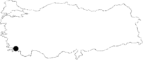 |
For photographs please click on the photo...  |
|
Type:
|
Flat Settlement |
|
Altitude:
|
m |
|
Region:
|
Aegean |
|
Province:
|
Mugla |
|
District:
|
Milas |
|
Village:
|
Damlibogaz |
|
Investigation Method:
|
Excavation |
|
Period:
|
Geometric Archaic |
|
|
|
 |
|
| Location: It is located in the Village of Damlibogaz to the west of the Sodra Mountain; 8 km far from the Milas District of the Mugla Province as the crow flies. It lies between the Kale Tepesi on which the village is situated and the Saricay Valley (ancient name Kybersos) to the east and its vicinity [Diler 2002:225]. |
| Geography and Environment: It is reported that the former bed of Saricay was running up to 40-50 m west of the present channel [Diler 2002:225]. Beyond Saricay; flowing immediately front of the Damlibogaz Village; extends a wide fertile plain. The city was established on a steep; and rocky hill [Tirpan 1999b:461-62]. |
| History: The uncovered wares include small vessels dating from the 3rd century BC as well as spouted handmade vessels from the Middle and Late Bronze Ages unearthed from the bed of Saricay. There lies a necropolis from the Geometrical and Orientalizing Period below the village settlement on the lower slopes of the Kale Hill. Illicit diggings have been reported [Diler 2002:225-226]. It is known that the city was a member of the Delian League during the 5th century BC under the name Kydae. She started to mint from the 2nd century. The coins include a depiction of the god of river as a symbol of Kybersos [Diler 2002:225]. |
| Research and Excavation: Other than the surveys carried out by Tirpan in 1997; it was excavated by Diler in 2000. |
| Stratigraphy: |
| Small Finds: |
| Remains: The Kale Hill on which the Damlibogaz Village rests is the acropolis of the ancient city; which is 150-160 m high; surrounded by a city wall. To the north; it borders with the deep valley of Kalebogazi; and to the south with the Gökgedik Hill. Surveys yielded a necropolis from the Early Bronze Age; a necropolis from the Geometrical-Archaic Period and a civil settlement [Diler 2002:229]. The excavations carried out in the south part of the city revealed architectural remains going back from the Late Geometrical Period to the 4th century. City Wall: The ring-type of walls surrounding the acropolis were erected in the drystone wall technique. Not much remained except the rock pavements; probably of burials or workshops; carved into the bedrock within the acropolis enclosed by walls made of solid rubble. The ruins have been almost disappeared due to recent destructions [Diler 2002:226]. The 3.3-3.5 m thick city wall reported to have been constructed by collected stones is of limestone. The surface of the stones used for the wall in various sizes was left untouched. No traces of tower are found. Based on the vessels dating from the Sub-Geometrical Period; it has been suggested that the city wall can be dated back to the 7th century BC Temple/Sanctuary: Temple of Apollo and Artemis: Both gods were worshipped under the common name "the Gods of Ancestors". This feature is similar to the temple in Olympus. The entrance is from the southeast. It is enclosed by a wall. The extant remains are only 2.44 m long. Necropolis/Graves: Grave 1: It is a carved-chamber which is located to the west of the mosque of the modern village; and it has been destructed due to illicit diggings. The 1 m wide corridor which is located at the same axis with the entrance is flanked by platforms; overlaid by burial beds made of slate. The burial pillows consist of three adjacent stones. The chamber at the end of the corridor measures 7.5x5.2x5.5 m. Twenty burials were found in the chamber. Majority of the skeletons were damaged. The burial customs indicate various periods. A goblet and a bronze fibula were uncovered as well as a limited number of potsherds from the Late Geometric Period [Diler 2002:226-227]. Grave 2: It lies 5 m north of the Grave 1; in the east-west direction. The entrance of this one-chamber tomb was supported by a small pile of stones against depression. Similar to the Grave 1; the corridor located at the same axis with the entrance is flanked by platforms; supported by overlaying burial beds made of slate. No destruction was observed except the damages on the vessels caused by stones falling from the grave's walls. A terracotta sarcophagus was found on the southern platform. The 8x5.5 m burial chamber was carved into the rock. Other than several vessels; which are mainly crater-like vases with big volumes; bronze fibulas; spearheads and arrowheads and curve-ended blades were unearthed. Presence of goblets is an indication of the fact that these vessels including liquids were left with the burials. It is believed that bones of burials had been placed onto these craters to open space for new burials. An analysis on the vessels showed the oldest ones dated back to the Late Geometric Period. In addition; some qualified vases indicate that the tomb might have been also used during the Sub-Geometric and Early Orientalizing Periods [Diler 2002:227-228]. The survey on the northern part of the village showed that the area was damaged as a result of illicit diggings; and it was probably "a necropolis of pithos burials". Among the potsherds uncovered are sherds resembling the spouted vessels of the Late Bronze Age; which have been already exhibited at the Museum of Milas. Additionally; some sherds of Bronze Age vessels were unearthed. Furthermore; a pithos from the Late Geometric Period was uncovered in situ during the excavations in the area of the bed of Saricay. It was probably used for storage purposes. The potsherds are dated back to the Archaic and Geometric Periods [Diler 2002:229]. To the southwest of the temple lies a few plain rock tombs. The excavations yielded that some of them are from the Hellenistic Period. Building with Unknown Function: The building with an oval plan and apsis have been preserved only up to a few rows of stones at the level of the foundation. The inner width is approximately 3 m. The wooden sockets used to support the upper structure are traceable. A wall in the east-west direction was found inside the building. It is believed that the wall belonged to another building erected after the building with an apsis plan lost its function [Diler 2002:228-229]. |
| Interpretation and Dating: |