|
©The Archaeological Settlements of Turkey - TAY Project
|
|
|
|
|
|
Büyük Güllücek |
|
|
For site maps and drawings please click on the picture...  |
For photographs please click on the photo... 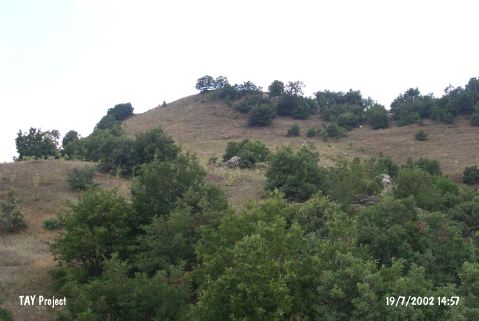 |
|
Type:
|
Mound |
|
Altitude:
|
1150 m |
|
Region:
|
Black Sea |
|
Province:
|
Çorum |
|
District:
|
Alaca |
|
Village:
|
Büyük Güllücek |
|
Investigation Method:
|
Excavation |
|
Period:
|
Middle |
|
|
|
 |
|
| Location: The site lies southwest of Çorum; northwest of Alaca District; southwest of Büyük Güllücek Village; 400-450 m from the village. Although its local name is Kaletepe or Nurlu Kale; it was recorded as Büyük Güllücek in the archaeological publications. It is easy to reach the site via the earth road southwest of the village [Kosay-Akok 1948:lev.CIX]. This road passes just below Kaletepe. Büyük Güllücek Village is located in a shallow valley. |
| Geography and Environment: The mound; 50 m high above the creek below; is located on the ridge between Kaledere and Agçeviran Creek. The diameter of this elevation is reported to be 50 m. The site is surrounded by forests nowadays. To the west is Bakacik Ridges; and Kazamat is across the mound. According to the surface collection; the inclined section towards Agçeviran Creek is observed to contain Iron Age and Classical Period terraced settlements. There are also remains of Greek and Roman settlements at the northern part of Agçeviran Creek. The creek flows westwards; joins with Koparan Creek and then empties into Yilgin Stream. |
| History: |
| Research and Excavation: Büyük Güllücek / Kaletepe excavation was conducted by H. Z. Kosay and M Akok for TTK (Turkish History Foundation) in 1947 and 1949. It seemed more like a salvage excavation because of the extreme damage caused by the illicit diggers. The recovery of Alacahöyük Level IV finds inside the pit opened by the illicit diggers was another important reason for excavating. |
| Stratigraphy: Iron Age and Phrygian buildings at the 2 upper levels; Chalcolithic Age buildings at the 2 lower levels were revealed. A very little amount of Hittite sherds were found. Main rock was reached at the lowest level. Traces of the Chalcolithic Age settlements are at the eastern and southern sections of the mound. |
| Small Finds: Architecture: Simple stone foundations at the lowest Chalcolithic Age level show that the buildings were square or rectangular in plan; and consisted of two or three rooms. Mud-brick walls were observed on the stone foundations or on floorment walls. At the upper building level; the mud-brick walls over stone foundations in 2-3 rows are observed to be built approximately in the same plan. Ovoid and round hearths were revealed on the plastered floors; inside the spaces. Not very populated; the settlement is observed to be a small village consisting of only four-five houses. The structures were built on terraces with respect to the formation of the hill. Pottery: Hand-made sherds in wares with surface colors of black and red on both faces; red on the exterior; black on the interior; red on the interior; black on the exterior were recovered. Some of them are burnished. Some vessels are decorated with white paint; lines and dots. Incised and excised decorations are observed as well as decorations with red; white; and light brown paint. There are motifs such as parallel lines; rhombs; dot rows; and vertical parallel lines. Beakers; bowls with pedestals; mugs; and jars with animal shaped handles were observed. Clay: Baked clay idols; amulet; spoon; spindle-whorl; animal figurine; and hook were recovered. The most attractive piece is the violin-shaped human figurine with a broken head; and a projecting circle on her belly. There is a swollen circle around her vagina; and her feet are not depicted [Kosay-Akok 1948:15]. A bell-shaped idol was recovered; the arms of which were represented in a schematic way. Its breasts look like buttons. Its gender is unknown; because the front part is broken. Chipped Stone: Although there is no information about the subject; the figures in the publication show that blade industry was dominant. Flintstone was the dominant raw material. Ground Stone: Burnished; flat axes; and hammers were recovered. Bone / Antler: Awls are abundant. Metal: According to the analysis; two flat axes are made of copper [Kosay-Akok 1948:478; Esin 1969:130]. Their edges* were not very circular. The first one's blade* is thin and long; while the other's is small. Both of them are flat necked*. This type of axes are interpretated to be used in daily life or to cut trees around Güllücek beginning from the Chalcolithic Age in Anatolia. |
| Remains: |
| Interpretation and Dating: Büyük Güllücek is an important site for displaying the cultural interrelations between Northern Anatolia and Balkans; consequently Southeastern Europe. Because the archaeolgical techniques were not well developed at the time of excavation; the Chalcolithic levels were not revealed properly. Moreover; pottery ware groups could not be well understood. Probably; a small agriral and stockraising community inhabited the site. They probably hunted animals with respect to the environmental features. Büyük Güllücek finds are thought to belong to a culture extending from Anatolia to Southeastern Europe. In 1962; H. Z. Kosay showed specific examples about the interrelations between Güllücek and Karanovo; Kirivodo; Soultan settlements; thus revealing the affinities of Northern Anatolia and Southeastern Europe [Kosay 1963:301]. |