|
©The Archaeological Settlements of Turkey - TAY Project
|
|
|
|
|
|
Bargylia |
|
|
For site maps and drawings please click on the picture... 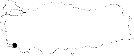 |
For photographs please click on the photo...  |
|
Type:
|
City |
|
Altitude:
|
m |
|
Region:
|
Aegean |
|
Province:
|
Mugla |
|
District:
|
Milas |
|
Village:
|
Kemikler |
|
Investigation Method:
|
Survey |
|
Period:
|
Hellenistic Roman |
|
|
|
 |
|
| Location: It is located 20 km southwest of the Milas District of of the Mugla Province; to the west of the Kemikler Village. |
| Geography and Environment: |
| History: According to Stephanus Byzantius; the establishment of the city is associated with Achilleus. Another viewpoint is that Bellerophontes founded the city to honor his friend Bargylos. It is known that she paid 1000 drahmi according to the Tribute List of Athens. According to Polybius [16; 12]; the influence of the Greek culture started in the 3rd century BC. The Bargylians adopted Artemis; the mother goddess of Kindyains; and obtained the control of the gulf together with Iassos. Although Philip V used the city as a headquarter in 201 BC; he retreated in 196 BC so that Bargylia gained her independence [Polybius 16; 24]. When Aristonicus conquered Myndus in 133 BC; which posed a major threat to Bargylia; it is known that Bargylia was released by the help of the epiphany of Artemis Kindyas. The city minted coins from the 1st century BC to the period of Septimus Severus; mainly depicted with Artemis and Pegasus [Bean 1976:143]. |
| Research and Excavation: The plan of the city; which was visited by Texier in 1835 and then in the mid 19th century; was drawn during the researchs carried out by Le Bas between 1824-44 [Madran 1989:230-231]. A survey was conducted by Rocca between 1988-90 and 1993-97. It takes place in the registered archaeological sites list prepared by Ministry of Culture and Tourism. |
| Stratigraphy: |
| Small Finds: |
| Remains: The investigations revealed that the buildings starting from the northwestern summit and extending up to the highland in the northwest-southeast direction were built in an orthogonal plan. The city plan is similar to the city of Cremna in Pisidia [Rocca 1992a:60-61]. The acropolis is divided into two parts; and the main buildings are mainly concentrated on the northwestern hill. The other part was surrounded by a wall during the Hellenistic Period. The findings yielded that this part was devoted for Residences and agora. The buildings dating to the 2nd century AD were built in the northwest-southeast direction [Rocca 1992b:72-73]. Harbor: To the southeast of the city found remains of a harbor; probably dating to the Ancient Period [Bean 2000:80]. City wall: Very little remained from the city wall in the acropolis. Probably it is dating from the 4th century BC [Rocca 1992a:60; Bean 1976:143]. It is indicated that the main gate has a pseudo arch [Akarca 1998:172]. Agora: It lies to the southeast of Bouleuterion. There are honorary inscriptions found in situ; dating back to the first quarter of the 3rd century [Rocca 1992a:61]. A pedestal for the sculpture of the Divine Alexandrus; another one from the Empire Period and a votive inscription for Titus [Rocca 1992b:73]. It was found out that the architectural elemens of the agora were used for the castle during the Byzantine Period. An inscription on one of the fragments revealed that the agora belonged to the Julius-Claudius Period; which was also confirmed by its similarity with the Portico of Tiberius in Aphrodisias in terms of architectural characteristics [Rocca 1994b:719]. Bouleuterion: It lies to the south of agora. It is known as "Antoninus' Bouleuterion"; and it has been well-preserved. The seating rows were supported by a vaulted underground gallery. Some composite capitals were uncovered. Also found are some remains; probably of a scaenae frons like façade [Rocca 1992a:61; 1992b:73]. Theater: It is situated to the east of the city where it overviews the mouth of bosphorus from the Mandalya Gulf to the Varvil Gulf. The stage building is of limestone. It is likely that the Logeion in the stage building was in Doric order. Presumably there were at least two more stories in the stage building [Rocca 1992a:61; 1992b:73]. Bath: There is a small bath near the plain. The masonry resembles the tombs in the necropolis. It is dated back to the mid-Roman Period. Traces of colored marbles were found at several places [Rocca 1992a:62]. Nymphaeum: It is located on the northwestern hill of the acropolis. It has four sides with a cistern in the middle. It has stairs. Initially it was thought that it was a temple. With a tetrastyle façade and Corinthian order of columns; it is compared to the Temple of Divine Hadrian in Ephesus; and it is believed that it might have had a Syrian pediment like it. However; it is also suggested that it might have been a Nymphaeum because of the large underground cistern [Rocca 1992a:61; 1992b:72-73]. Temple/Sanctuary Area: The first temple situated to the east of Nymphaeum; lies above the cavea of the theater. As it is situated above the theater; it also overlooks the bosphorus between the Mandalya and Varvil Gulfs. Therefore; it was suggested that the Temple of Aphrodite Ampelius should have been located here. According to the information provided by Strabo; the temple functioned like a lighthouse due to the light which could not have been extinguished by rain or wind [Strabo 14; 2; 20]. It dates back to the Hellenistic Period [Rocca 1992a:61]. An altar decorated with god figures was found on the terrace; and today it has been preserved at the Museum of Milas [Rocca 1992b:73]. The material which was found to have been reused for the construction of a church belongs to a second temple. It has been suggested that this material can be from a small temple with in antis plan in an Ionic order or a larger temple with a peripteral plan. It probably dates back to the beginning of the 3rd century BC [Rocca 1999:552-553]. Necropolis/Graves: The graves are scattered on the hill of the two peninsulas and skirts of the Karaköl Hill. The necropolis dating back to the mid-Roman Period extends along the road; running to the city on the eastern part of the peninsula. These house-like tombs have barrel vaults. The schistic blocks were irregularly arranged using mortar [Rocca 1992a:62]. Building with unknown function: The building is located on the hill where the Bargylia settlement is situated; on the road linking the agora with the area of theater-temple buildings. The remains from the façade; supposedly of a tetrastyle; have been scattered around. The façade consists of two pillars and two columns rising on Attic pedestals; topped with Corinth capitals; an architrave with three fascias with inner decorations; a frieze decorated with achantus leaves; corniche and cyma. It is suggested that this façade probably stood over the stairs of the building. Although its function has not been elucidated yet; it is indicated that it has similarities with the Great Propylon in Kremna and the Gate of Hadrian in Ephesus [Rocca 1999:551-552]. Miscellaneous: It was found out that the architectural fragments used in the construction of a church as reused material belong to a stoa in Doric order. The columns were grooved in Ionic style. It is dated to the end of the Hellenistic Period and beginning of the Roman Period [Rocca 1999:552-553]. |
| Interpretation and Dating: |