|
©The Archaeological Settlements of Turkey - TAY Project
|
|
|
|
|
|
Amos |
|
|
For site maps and drawings please click on the picture... 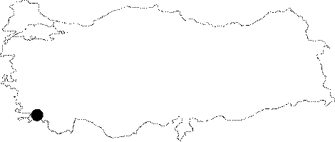 |
For photographs please click on the photo...  |
|
Type:
|
City |
|
Altitude:
|
m |
|
Region:
|
Aegean |
|
Province:
|
Mugla |
|
District:
|
Marmaris |
|
Village:
|
Hisarburnu |
|
Investigation Method:
|
Survey |
|
Period:
|
Roman Hellenistic |
|
|
|
 |
|
| Location: It lies on a hilltop over cape Hisar in Kumlubük Mevkii of Turunç town in Marmaris District of Mugla. The hill is also known as Asarcik. |
| Geography and Environment: City locates across Rodos Island. |
| History: |
| Research and Excavation: It was surveyed by Bean and Cook in 1954. |
| Stratigraphy: |
| Small Finds: |
| Remains: The hill; probably the acropolis; is surrounded by a defense wall erected by the ordered polygonal technique; dating back to the Early Hellenistic Period. It is pierced by towers; and a gate to the north. It is known that it has been preserved up to 3-4 m [Bean 1976:51]. The theater is located on the northeastern slope of the acropolis. This small building has been well-preserved. The analemma is approximately 5 m high. In the orchestra there is a depiction of offering a sacrifice to Dionysus in two works on an altar. Only the foundations of the stage building; which was divided into three sections; survived to the present day [Bean 2000:165]. The temple is located in the western end of the acropolis according to Bean. Having a templum in antis plan; it is approximately 3 m long. It most probably belonged to Apollo Samnaios [Bean 1976:51]. The information on the stele which was uncovered at the Bakicak Mevkii between Gölenye and the shore revealed that it was originally erected for the Sanctuary of Apollo Samnaios in Amos. Architectural elements of a large building were found during the survey in the Gölenye Plain. Similar remains were found at so called Dereyüzü around the hills to the south. The potsherds collected from the site do not date earlier than the Roman Imperial Period. The remains on a small hill at the Bakicak Mevkii belong to a church. The above mentioned stele was most probably brought here from the sanctuary in Amos in order to be used for the construction of the church. Similarly; it has been suggested that the other ancient remains in Gölenye were brought here from Amos. On a small terrace on the northern slope of the acropolis; inscriptions were found related with rental agreements dating to 200 BC Based on the information in those inscriptions and by Aischines; it is known that the land was fertile; which most likely refer to the plain in the village of Gölenye. The researcher believes that the Sanctuary of Apollo was located in Amos. A votive offered by one of the Apollo priests and an inventory of the temple were uncovered on the terrace where the rental agreements were recovered in Amos. The land must have been belonging to the temple [Bean-Cook 1957:60; Bean 2000:165]. Based on the information from the inscriptions about rental agreements; it can be concluded that Rhodes developed an agricultural system during 200 BC According to these inscriptions; the tenant was responsible from constructing a cottage; growing a vineyard; planting fig trees and cultivating a field for grains [Bean 2000:165]. |
| Interpretation and Dating: |