|
©The Archaeological Settlements of Turkey - TAY Project
|
|
|
|
|
|
Alinda |
|
|
For site maps and drawings please click on the picture...  |
For photographs please click on the photo... 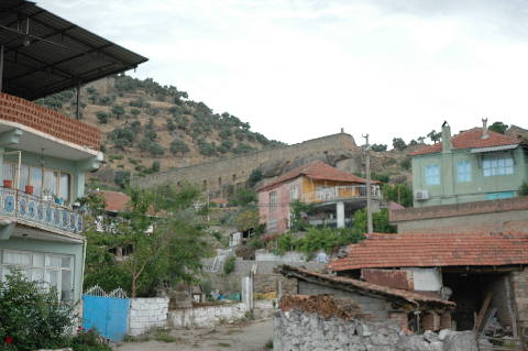 |
|
Type:
|
City |
|
Altitude:
|
m |
|
Region:
|
Aegean |
|
Province:
|
Aydin |
|
District:
|
Karpuzlu |
|
Village:
|
Merkez |
|
Investigation Method:
|
Survey |
|
Period:
|
Classical Hellenistic Roman |
|
|
|
 |
|
| Location: It is located within the Karpuzlu District (Demircideresi) of the Aydin Province. On the road running from Aydin to Mugla; a deviation to the southwest is made approximately after 30 km. The ancient city can be reached after 26 km [Özkaya et al. 1999:299]. |
| Geography and Environment: |
| History: The location on the road running from the Central Anatolia to the Aegean shores increased the city's strategical significance. Investigators assume that the city referred as Iyalanda in the Tawagalawas letter written by the Hittitian King Mursilis II to the King of Ahhiyawa is; in fact; Alinda. Some archaelogical excavations are required in order to confirm this assumption [Özkaya-San 2000:263-264]. The city paid tribute to the Delian League in the 5th century BC [Özkaya-San 2003:242]. As reported by Strabo; Ada; sister of Mausolus; was exiled to Alinda by her brother Pixodaros about 340 BC. Ada; cooperating with Alexander the Great who arrived to Caria in 334 BC; surrendered the city to him. In return; Alexander appointed her Queen of Caria; and handed over to her the siege of the Alinda acropolis [Strabo 14; 2; 17]; which were followed by significant changes in the city. Renaming the city "Alexandria by the Latmos" and possession of an Aphrodite sculpture by Praxiteles were related with such changes. With Ada restoring to her throne; it seems that the city had immediately come under the influence of the Greek culture when the good relationship established with the Macedonians is considered. During the researchs carried out by Laumonier; symbols of Zeus and Apollo (during the reign of Pius; Severus and Caracalla) as well as of labrys and bundle of lightning were seen on the coinage belonging to the Roman Empire Period [Anabolu 1967:88; 90-91; Laumonier 1958:432]. Alinda is known to continue to mint its own coins until the 3rd century AD [Ozkaya et al. 1999:300]. |
| Research and Excavation: Alinda was first visited by Pococke and Chandler in the 18th century. It was first Fellows who claimed that these ruins belonged to Alinda; and that was; later on; confirmed by the coins uncovered in the vicinity [Paton 1896:240]. Some studies were carried out in the agora by Tremaux and Le Bas in the 19th century; and by Kiepert and Fabricius in 1889 [Anabolu 1967:89]. Subsequently; researchs were conducted by Anabolu; Bean and Doruk [Özkaya et al. 1999:300-301]. It takes place in the registered archaeological sites list prepared by Ministry of Culture and Tourism. |
| Stratigraphy: |
| Small Finds: |
| Remains: The city had been naturally protected because of the steep slopes in all directions except two acropolises; one 150 m and the other 180 m high; and southwestern part of the which was founded on a slope declining toward southwest. Starting from the Hellenistic Period; the settlement enlarged toward the southwestern slope. Based on the ruins of the western acropolis; it appears that it had been intensely inhabited; however no houses were identified. The two acropolises are connected with an inclined road encircled by a city wall to the south. The most significant buildings of the city are concentrated in the lower acropolis [Özkaya et al. 1999:301; 303]. City Wall: The city wall has been; in general; well preserved with a total lenght reaching up to 1.400 m. Built with the local granite blocks; it was erected using the isodomic masonry. The edges of the wall blocks were modified; and the surfaces left bossaged; using lentils in between. Demonstrating local characteristics of material and workmanship; it was built in accordance with the nature of the land. The towers; only 19 being identified up to date; are similar to the city wall in terms of construction techniques. The most common technique was the use of transversal blocks among horizontal blocks. The same technique can be traced in the aqueduct; buildings in the upper acropolis; theater and agora. Also observed in the Northern Caria settlements such as Alabanda; Amyzon and Teke Kale; it is likely that this technique was employed in the Carian region from the 7th century BC - early 6th century to the 3rd-2nd centuries BC Gaining more importance with the Queen Ada; it has been suggested that the city wall and towers had been mainly constructed in Alinda in the 4th century BC. The upper acropolis to the west of the city has also been surrounded by a city wall made of local granite. There are two towers both on the west and east. The eastern towers seem to support a gate. To the south; there are the remains of a second city wall with ruins of one tower on each end. The southern part of the inclined road between the two acropolises is protected by a city wall. Of the towers in both acropolises; the ones in the lower acropolis seem to have been preserved better. Those rectangular towers have two stories; and were built approximately in the same height. Among them; a very well preserved one built with a fine ashlar masonry overlooks north of the city. The second story is lighted by a window. The four sockets on the façade indicate that there was an access to the upper story through wooden stairs. Similar towers can be seen in Teke Kale; Ataulusu; Kurun Dere; Hasanlar; Amyzon and Alabanda. Researchers relate the size of the tower with its military functions [Ozkaya et al. 1999-301-302; Ozkaya-San 2003:236]. Agora: It is located to the southwest of the lower acropolis; and southeast of the theater. It measures 35x100 m. It appears that there is no portico to the west; however it is likely that there might have been a stoa to the north; and also there is a 3-story; thin and long stoa building in the east-west direction to the south. Measuring about 100x12 m; the first two stories of the stoa are under the agora level while the top level is equal. Mainly granite was used in the building. The outer surface of the enclosing wall is bossaged. Pseudo-isodomic masonry was used. The walls being erected without any stone anchor; insert or mortise have binding stones. The lower story is divided into two by a party wall parallel to the longer sides. The southern chambers lead into a narrow terrace through 12 doors; some chambers being connected and some doors with arched tops. There are small-sized and high windows on the southern walls of the chambers; which are believed to have functioned as shops or small workshops. This feature is compared to the Southern Stoa of the Agora in Assos; Agora Building of Aigai and Northern Building of Corinth [Doruk 1988:1126-1127]. Constriction at the middle story of the southern wall and the floor joists enabled the building to have grounded along its width. The Middle story is divided into two by a row of 20 double half-columns; which are in a Doric order. On the southern wall there is a row of windows at different levels. The 37 windows in the lower row were placed more frequently compared to the ones in the upper row. Additional lighting was provided by inwardly inclined windows. Although the slit on the western front of the second story was described as a door by some researchers; some others suggest that it was used to facilitate the ventilation and also throw the decayed goods out of the storage [Doruk 1988:1129]. It is suggested that it might have functioned as a general store house as it was lighted poorly and access was restricted. The upper story was divided by a row of columns in the middle; and there is an additonal row of colums on the façade facing north. It is difficult to be definitive due to restricted amount of building elements survived to our day. It might have been built as a promenade away from the influence of sun and rain as well. It was proposed that the columns at this story were also topped by Doric capitals based on the fact the columns in the middle story were in Doric order and no Ionic order was observed in the neighbouring buildings [Doruk 1988:1131]. Each of the narrow fronts houses five pedestals with balustrades in between. Similarly; it has been proposed that there is a row of columns with pedestals to the southern front of the upper story. Although whole elements of the upper story are not available; it supposedly had a gable roof. Evaluations on two architrave blocks uncovered in the agora revealed two fasciae and a convex profile above it. It is considered that these blocks may have belonged to the stoa building even tough the architrave has usually no fascia in Doric buildings [Doruk 1988:1133]. The stoa is similar to the stoa in Heracleia under Latmos when it is considered that the southern wall was built right in front of the agora terrace. It was concluded that the agora was built later than the stoa; considering the inclination of the land to the east and west; and the lack of a second wall; ie. a terrace wall. The same is valid for the stoa and agora in the Heracleia under Latmos [Doruk 1988:1125-1126]. There is discrepancy in the interpretations for the building date of the stoa. It can be dated back as early as beginning of the 3rd century BC based on its size. And this dating goes back as early as the 2nd century BC based on its multi-story structure and frequency of arched doors. Very common in Pergamon and its vicinity; this type of stoa is again linked to the architecture of Pergamon; however it is unclear if Alinda was influenced by it. The pseudo-isodomic masonry employed on the walls of the stoa building can also be found in the southern stoa of the agora in Heracleia under Latmos; dating to the Hellenistic Period as well as the agora building of Aigai and the stoae of Priene. Based on these information; for now; it is possible to state that the stoa building of Alinda dates back to the Late Hellenistic Period [Doruk 1988:1118-1137; Ozkaya et al. 1999:304; Ozkaya-San 2003:236]. Bouleuterion: It is located on the terrace to the northwest of the lower acropolis. A foundation with a semi-circled form consisting of rectangular stones; and also square blocks; probably of the column bases; was found. Its function is still indefinite although it was believed to be the bouleuterion because of its apsidal plan [Ozkaya et al. 1999:303]. Theater: It is located on the southern slope of the lower acropolis. The cavea; which was built on a natural elevation; has approximately 31 rows of seats. The rear part was encircled by a surrounding wall; and divided into two by a diazoma. Two vomitoria with barrel vaults lead into the diazoma through arched gateways. The retaining walls (analemmata) of the cavea were erected in the pseudo-isodomic style. It is obvious that no addition was made in later periods as the parodoi; i.e. the entrance corridors; retain their specific structures. The orchestra has a horseshoe shape. Little or nothing remained from the stage building; but it can be disclosed by excavation. It was noted that a L-shaped vestibule; which was supposedly built for entrance from the backside on the western part of the theater; was resembling to a vomitorium in respect to the masonry. The boukranion relief on the keystone where it opens to the west is similar to the vomitorium in the east. The stage building is nearly 29 m long in the east-west direction. It has been found that a corridor adjacent to the retaining walls in front of the stage building leads into the backstage rooms and the scene. Furthermore; remains of a wall were found behind the stage building; which is probably the terrace wall of the theater. It was protruded for 5 m from the stage building during the Roman Period to allow more players on the stage. There were parodoi on both sides. It is presumably dated back to the Hellenistic Period as indicated by its masonry [Bean 2000:206; Ozkaya et al. 1999:303-304; Ozkaya-San 2003:240]. Stadium: To the southeast of the city lies the remains of a stadium. Cistern: There are cisterns carved into the bedrock where the inclining land makes a start between the two acropolises. The edges of the rectangular cisterns were rounded; and their top was covered by thin and long blocks. Their inner parts are coated with plaster. Besides; it is proposed that the building complex preserved with its upper structures to the north of the city might have been a cistern as well. It lies on the skirt of the lower acropolis to the northeast. It is believed that the complex belongs to a period following the Roman Period [Ozkaya et al. 1999:302; Ozkaya-San 2003:241-242]. Aqueduct: It lies in the northwest-southeast direction. The 40 cm wide water channel over the arches is located on a base consisting of rectangular blocks placed transversely along the wall. The top of the water channel was covered by semi-finished blocks; and small rocks were positioned on the base of the channel in order to avoid any leakage. Arches rise on four very well preserved pillars to the west of the upper acropolis; pierced by a gate in the extension to the west. An extension; probably a supporting wall; was found where the first pillar starts at. With a masonry differing from the other sections; it might have been used to change the direction of the aqueduct. Therefore; it can be concluded that it had two construction phases. It is assumed that its direction was changed to avoid any damage to the sarcophagi in areas where it passed through. There are remains of some water pools with a square plan at where the aqueduct combines with the walls of the upper acropolis [Ozkaya et al. 1999:302-303; Ozkaya-San 2003:241]. Temple/Sanctuary: On a terrace to the northwest of the lower acropolis; there is a building which is presumably a temple. Lying in the east-west direction; it measures 9.20x13.90 m; consisting of a pronaos and a cella. It has been preserved only up to the podium level. The plan of the temple is templum in antis; and it is enclosed by a temenos. There are traces of foundations of some buildings with indefinite functions within the area enclosed by temenos; which are; probably; of religious buildings [Ozkaya et al. 1999:303]. Necropolis/Graves: It includes the northern necropolis with abundant monumental burials; the southern necropolis with basin and sarcophagus types of burials and the northeastern necropolis with a heroon. One of the three monumental burials excavated in the northern acropolis is located on an elevated podium in the east-west direction. The burial chamber consists of well-cut and big local blocks. The outer part was worked elaborately while it is not the case for the inner part. Failure to find an entrance indicates that it probably didn't have one. In the burial chamber; there are three basins for sarcophagus carved into the bedrock. The second monumental burial is similar to the first one in terms of its architectural characteristics despite the absence of a podium. Partly carved into the bedrock; it has two-stories. A total of four graves was found; two in the lower story; and two in the upper one. The second story is accessible from an aperture on the floor. The third monumental burial consists of a narrow dromos and a small front room. Supposedly there were two klines in the rectangular burial chamber. The sarcophagi located on the northern; southern and western skirts of the acropolis stand on bedrock or pedestals. Their basins are of the local stones. The shape of the lids are similar to the Lycian gabled roofs. The narrow and long sides of the lids are decorated with reliefs for carrying and ornamental purposes. Chamosorions are also alike the sarcophagi; but they were built carving deeply into the bedrock. Arranged as single; twin or multiple groups; they are usually defined as "Carian type". Their alikes can be seen in the interior land of Caria and Heracleia under Latmos. Researchers suggest that the Alinda burials were built more elaboratively. It is suggested that multiple burials might have been arranged as family graves. The graves other than these have a simple entrance; which are called "common type". They are surrounded by semi-dressed blocks on both sides; and topped by long stone blocks. It is suggested that probably they are mass burials; considering their dimensions. Most of them are dated to the similar period; and some later examples were found at several parts of the city [Ozkaya et al. 1999:305-308; Ozkaya-San 2000:265-266]. Workshop: There lies a press-bed and a rounded collection pool for liquids in front of it on the flat neck between the two hills. The bottom of the press-bed had been flattened and inclined toward the pool. At the bottom there are channels for drainage of the liquid; which are also surrounded by different sizes of container nests. An olive oil or wine press was uncovered in the area where the cisterns were found. The press consisting of a 1.6 m wide press-bed carved into the bedrock and a collection pool of 80 cm diameter for liquids is a small one; which therefore might have been functioned to meet the daily requirements [Diler 1996:316; Ozkaya 1999:302]. Miscellaneous: It can be concluded that the Artemis and Zeus cults were dominant in the city in accordance with an inscription found on a garden wall during the survey in the Karpuzlu District [Ozkaya et al. 1999:309]. |
| Interpretation and Dating: |