|
©The Archaeological Settlements of Turkey - TAY Project
|
|
|
|
|
|
Hamaylitarla / Buruneren |
|
|
For site maps and drawings please click on the picture...  |
For photographs please click on the photo... 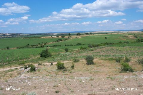 |
|
Type:
|
Workshop |
|
Altitude:
|
0 m |
|
Region:
|
Marmara |
|
Province:
|
Tekirdag |
|
District:
|
Sarköy |
|
Village:
|
Kizilcaterzi |
|
Investigation Method:
|
Survey |
|
Period:
|
EBA II |
|
|
|
 |
|
| It lies next to an old limestone quarry; immediate north of the Kizilcaterzi-Kavakköy motorway; about 5 km east of Kizilcaterzi Village; some 14 km west of Sarköy District; Tekirdag Province. It is 1 km southwest of the hill known as Tekke Tepe and consists of an atelier and a settlement located west of the area called "Limestone quarry" [Özbek 2000:1]. There is a fresh water spring nearby the atelier which overlooks the Marmara Sea. The atelier area measures 80x80 m and is at an altitude of 100 m. Some of the upper cultural layers were destructed due to the intense cultivation [Özbek 2000:1]. A polished stone axe from Buruneren Çiftligi is preserved in the Ankara Museum of Anatolian Civilizations. The survey conducted by M. Özdogan in 1982 exposed that the polished stone axe might have come out of another settlement on the western terraces of the Kazanagzi Stream as there was no prehistoric pottery and polished stone axes found in this settlement. Meanwhile; a survey conducted by the Museum of Tekirdag proved that the settlement surveyed by M. Özdogan is; in fact; not Buruneren; and the main settlement lies next to a limestone quarry; 1 km southwest of Teke Tepe which is also known as Hamaylitarla. Vast majority of the pottery recovered belongs to the Neolithic Age. EBA pottery is very rare and they can be dated to Troy I. It takes place in the registered archaeological sites list prepared by Ministry of Culture and Tourism. |
| Location: It lies next to an old limestone quarry; immediate north of the Kizilcaterzi-Kavakköy motorway; about 5 km east of Kizilcaterzi Village; some 14 km west of Sarköy District; Tekirdag Province. It is on the border of Sarköy and Gelibolu; on the slope of the mountains facing the Marmara Sea; in the lands of Buruneren Farm. It is 1 km southwest of the hill known as Tekke Tepe and consists of an atelier and a settlement located west of the area called "Limestone quarry" [Özbek 2000:1]. The limestone quarry begins from the slope of the mound and runs towards west parallel to the road. |
| Geography and Environment: There is a fresh water spring nearby the northern part of the atelier which overlooks the Marmara Sea. This water spring forms the stream that runs from the middle of the settlement and divides its surface into two portions. The atelier area measures 80x80 m and is at an altitude of 100 m. Some of the upper cultural layers were destructed due to the intense cultivation [Özbek 2000:1]. |
| History: |
| Research and Excavation: |
| Stratigraphy: |
| Small Finds: |
| Remains: |
| Interpretation and Dating: |