|
©The Archaeological Settlements of Turkey - TAY Project
|
|
|
|
|
|
Naltepesi |
|
|
For site maps and drawings please click on the picture...  |
For photographs please click on the photo... 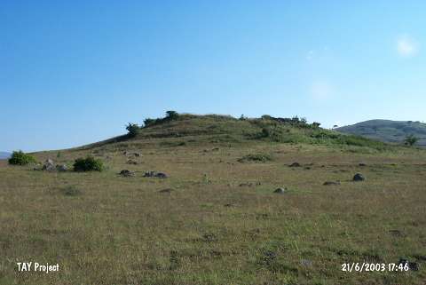 |
|
Type:
|
Upland Settlement |
|
Altitude:
|
1440 m |
|
Region:
|
Black Sea |
|
Province:
|
Ordu |
|
District:
|
Mesudiye |
|
Village:
|
Karabayir |
|
Investigation Method:
|
Survey |
|
Period:
|
|
|
|
|
 |
|
| It is situated on a natural elevation at the center of a plain, which is rich in water resources lying 2 km northwest of the Karabayir Village. The settlement was named after the hill as Naltepesi. It was discovered by M. Özsait in 1990 and Late Chalcolithic and EBA sherds were collected from the surface. It has been heavily destroyed by treasure hunters just like the other archaeological sites in the region. The painted Phrygian sherds indicate that the conditions were also suitable for inhabitation during the first half of the 1st Millennium BC [Özsait 1992a:362]. |
| Location: |
| Geography and Environment: |
| History: |
| Research and Excavation: |
| Stratigraphy: |
| Small Finds: |
| Remains: |
| Interpretation and Dating: |