|
©The Archaeological Settlements of Turkey - TAY Project
|
|
|
|
|
|
Tepesidelik |
|
|
For site maps and drawings please click on the picture...  |
For photographs please click on the photo... 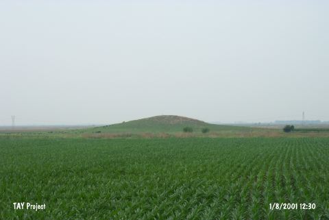 |
|
Type:
|
Mound |
|
Altitude:
|
80 m |
|
Region:
|
Mediterranean |
|
Province:
|
Adana |
|
District:
|
Ceyhan |
|
Village:
|
Merkez |
|
Investigation Method:
|
Survey |
|
Period:
|
|
|
|
|
 |
|
| It was researche dwithin the scope of the "Adana (Ceyhan) and Kayseri (Develi) Surveys" performed by S. Girginer et al. in 2005. It is a 12 m high mound. The agricultural activities outside the northern slope of the mound destructs the mound. It is in a location near the area where Ceyhan river changes its course. There are pottery belonging to straw tempered Chalcolithic Age group; as well as pottery belonging to EBA; and 2nd Millenium BC; Roman-Byzantien Periods; and obsidian and silex production waste; and blades [Girginer 2007:176-177]. |
| Location: |
| Geography and Environment: |
| History: |
| Research and Excavation: |
| Stratigraphy: |
| Small Finds: |
| Remains: |
| Interpretation and Dating: |