|
©The Archaeological Settlements of Turkey - TAY Project
|
|
|
|
|
|
Bunus |
|
|
For site maps and drawings please click on the picture...  |
For photographs please click on the photo... 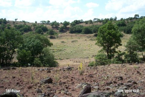 |
|
Type:
|
Workshop |
|
Altitude:
|
1675 m |
|
Region:
|
Central Anatolia |
|
Province:
|
Aksaray |
|
District:
|
Merkez |
|
Village:
|
Gösterli |
|
Investigation Method:
|
Survey |
|
Period:
|
Aceramic |
|
|
|
 |
|
| The site; which yielded obsidian finds; lies at Çukuryer Mevkii; west of Acigöl and east of Mount Kiziltepe; 2.2 km west of the village of Gösterli; east-northeast of the city of Aksaray. Bunus was discovered by N. Balkan-Atli in 1996 during her 1996 survey of workshops and ateliers in this region. The researcher collected cores with single and opposed striking platforms; crested blades; flakes; scrapers and splinter pieces. This site is believed to be an Aceramic Neolithic habitation site/atelier. |
| Location: |
| Geography and Environment: |
| History: |
| Research and Excavation: |
| Stratigraphy: |
| Small Finds: |
| Remains: |
| Interpretation and Dating: |