|
©The Archaeological Settlements of Turkey - TAY Project
|
|
|
|
|
|
Gedikli / Karahöyük |
|
|
For site maps and drawings please click on the picture... 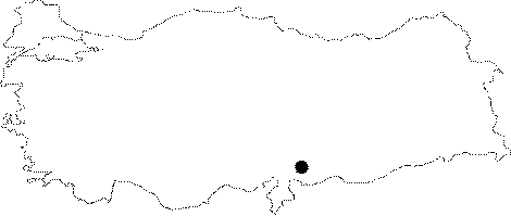 |
For photographs please click on the photo... 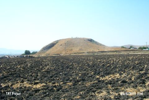 |
|
Type:
|
Mound |
|
Altitude:
|
540 m |
|
Region:
|
Mediterranean |
|
Province:
|
Gaziantep |
|
District:
|
Nurdagi |
|
Village:
|
Gedikli |
|
Investigation Method:
|
Excavation |
|
Period:
|
|
|
|
|
 |
|
| Location: It is partly obscured by the village it was named after; 23-24 km northeast of the Islahiye District; northwest of the Gaziantep Province. Although it is locally known as Karahöyük; it is referred to as Gedikli in the archaeological literature to prevent any confusion with the other settlements called Karahöyük. |
| Geography and Environment: Gedikli Karahöyük is one of the biggest mounds of the plain. It measures 24 m in height and 240x190 m in dimensions. The eastern and western foothills and northern slope have been severely damaged due to removal of soil. The cemetery on the southeastern foothill came out as a result of such damage. |
| History: |
| Research and Excavation: Gedikli-Karahöyük was first referred in the map of R. Koldewey, one of the excavators at Zincirli. It was studied in 1907 by J. Garstang among the mounds of Sakçagözü, followed by M.V. Seton-Williams, J. Waechter and J. du Plat Taylor, who conducted soundings at Coba Höyük in 1949. In 1951, S. Gögüs, director of the Gaziantep Museum, collected more than 10 intact vessels from the eastern section, which had been destroyed by soil removal (and, later on, it turned out to have been a grave). The first systematic surveys were initiated in 1958 under the direction of U.B. Alkim on behalf of the Istanbul University, and continued in 1963, and the mound was excavated between 1964 and 1967. Gedikli excavations were conducted in order to contribute to the evaluations of the investigations conducted by the same group of archaeologists at Tilmen Höyük and its surroundings, and therefore they were not extensive [Alkim-Alkim 1966:2; Alkim (H.) 1979:135]. As there are many other mounds called Karahöyük in Anatolia, it is much better to call this site Gedikli to prevent any confusion [Alkim-Alkim 1966:3]. It takes place in the registered archaeological sites list prepared by Ministry of Culture and Tourism. |
| Stratigraphy: Based on the finds collected from the surface, presence of the Early Bronze Age, 2nd Millennium BC, 1st Millennium BC, and Roman Period settlements was identified on the mound [Alkim 1966:3]. During the excavations, sounding A was opened on the northeastern terrace of the mound for better understanding of the stratification of the mound. And, based on this sounding, the stratification is as follows; Ottoman-Turkish, Byzantine, Roman, Hellenistic, two-phase Iron Age (Level I) and Late Chalcolithic Age? (Level IV) [Alkim-Alkim 1966:6]. |
| Small Finds: Architectural Remains: Some wall remains made of limestone dating to the Iron Age were identified in the southwest-northeast direction [Alkim-Alkim 1966:6]. Pottery: Painted and monochrome potteries were uncovered. The painted samples include sherds with parallel band decorations in dirty brown on a light background and dark brown band decorated ware. Monochrome kitchen utencils include plates, pots and fragments of pithoi. Bone/Horn/Ivory: A bone awl fragment was found at Ib. Ornaments: A bronze bracelet was found at Ia [Alkim-Alkim 1966:7]. |
| Remains: |
| Interpretation and Dating: While presence of two phases during the Iron Age indicates intense occupation in the plain, the view that the settlement can be associated with the first quarter of the 1st Millennium BC becomes more prominent [Alkim-Alkim 1966:7]. |