|
©The Archaeological Settlements of Turkey - TAY Project
|
|
|
|
|
|
Dervisli |
|
|
For site maps and drawings please click on the picture...  |
For photographs please click on the photo... 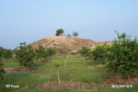 |
|
Type:
|
Mound |
|
Altitude:
|
70 m |
|
Region:
|
Mediterranean |
|
Province:
|
Adana |
|
District:
|
Seyhan |
|
Village:
|
Dervisler |
|
Investigation Method:
|
Survey |
|
Period:
|
|
|
|
|
 |
|
| It is a small mound with a height of 7 m, 3 km south of the Dervisli Village, south of the Caputçu-Dervisli motorway, 24 km southwest of the provincial center of Adana. It lies 1.5 km west of the Seyhan River. Based on the sherds collected from the surface during the Cilician Survey conducted by M.V. Seton-Williams in 1951, following eras were identified on the mound: - Chalcolithic Age - Early Bronze Age - 2nd Millennium BC - Iron Age - Hellenistic and Roman Periods [Seton-Williams 1954:153,findspot no. 135] |
| Location: |
| Geography and Environment: |
| History: |
| Research and Excavation: |
| Stratigraphy: |
| Small Finds: |
| Remains: |
| Interpretation and Dating: |