|
©The Archaeological Settlements of Turkey - TAY Project
|
|
|
|
|
|
Çattepe - Tilli |
|
|
For site maps and drawings please click on the picture... 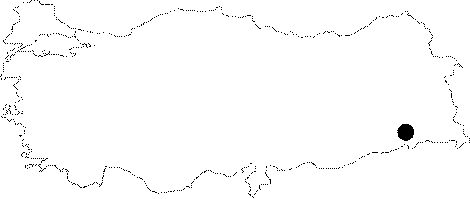 |
For photographs please click on the photo...  |
|
Type:
|
Mound |
|
Altitude:
|
450 m |
|
Region:
|
Southeastern Anatolia |
|
Province:
|
Siirt |
|
District:
|
Kurtalan |
|
Village:
|
Çattepe |
|
Investigation Method:
|
Survey |
|
Period:
|
New Assyrian Empire Period |
|
|
|
 |
|
| It rests on a peninsula where the Botan and Tigris Rivers join at [Velibeyoglu et al. 2002:788]. It lies next to the Çattepe (Tilli) Village, west of the Tigris River and Botan Stream confluence, south of Kurtalan, southwest of the provincial center of Siirt. It is also known as Tilli. It is a triangular cone-shaped mound with a height of at least 9 m [Algaze 1989:254]. The southern section rests on a natural rock formation, which provides protection from rise of water during any increase in river flux while the northern section was founded on a mound where the western part was protected by riverside fortifications. The settlement is occupied by a cemetery in the confluence of two rivers while the northern section is occupied by a village settlement. Two elevations, parallel to each other, are observed in front of the village, again occupied by a contemporary necropolis. Wide terrains suitable for cultivation are very rare to the north of the settlement [Velibeyoğlu et al. 2002:788]. The mound was discovered during a survey in the Botan region conducted in 1988 under the direction of Algaze as part of the Tigris-Euphrates Archaeological Reconnaissance Survey Project [Algaze 1989:254]. It was re-investigated in 2000 by a team under the direction of J. Velibeyoglu, A. Schachner and S. Schachner during the Botan Valley and Çattepe (Tilli) Survey as part of the METU TAÇDAM Salvage Project of the Archaeological Heritage of the Ilisu and Carchemish Dam Reservoirs [Velibeyoglu et al. 2002:783]. The Çattepe survey yielded ceramics from the Prehistoric Period, Iron Age, Ancient Period and Islamic Period [Velibeyoglu et al. 2002:794]. A few sherds from the Neo-Assyrian Period and information obtained from inscriptions found at Çattepe suggest dating to the early 9th century BC at earliest. Iron Age ceramics are found only on the southern end while the Late Ancient Period and Middle Age materials are mainly concentrated under the modern village as well as the area near the Tigris River and to the north of the ditch system. In Çattepe, majority of the forms are typologically independent of Northern Mesopotamia, except a few sherds, probably of Neo-Assyrian origin. It takes place in the registered archaeological sites list prepared by Ministry of Culture and Tourism. |
| Location: |
| Geography and Environment: |
| History: |
| Research and Excavation: |
| Stratigraphy: |
| Small Finds: |
| Remains: |
| Interpretation and Dating: |