|
©The Archaeological Settlements of Turkey - TAY Project
|
|
|
|
|
|
Baglama |
|
|
For site maps and drawings please click on the picture...  |
For photographs please click on the photo... 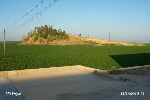 |
|
Type:
|
Mound |
|
Altitude:
|
100 m |
|
Region:
|
Mediterranean |
|
Province:
|
Hatay |
|
District:
|
Merkez |
|
Village:
|
Marasbogazi |
|
Investigation Method:
|
Survey |
|
Period:
|
|
|
|
|
 |
|
| It lies on a flat ground formed by the Lake Amik on the eastern side of the motorway leading to Kirkhan, northwest of the lake, northeast of Hatay Province. Locally it is known as Ain al Samak. The mound was discovered by R. Braidwood, and based on the sherds collected from the surface, it is suggested that it had been inhabited during the Jemdet Nasr Period (EBA I), 2nd and 1st Millennia BC, and commanded the road to the Bailan Passageway [Sagona 1984:314-338]. It takes place in the registered archaeological sites list prepared by Ministry of Culture and Tourism. |
| Location: |
| Geography and Environment: |
| History: |
| Research and Excavation: |
| Stratigraphy: |
| Small Finds: |
| Remains: |
| Interpretation and Dating: |