|
©The Archaeological Settlements of Turkey - TAY Project
|
|
|
|
|
|
Asagi Salat |
|
|
For site maps and drawings please click on the picture... 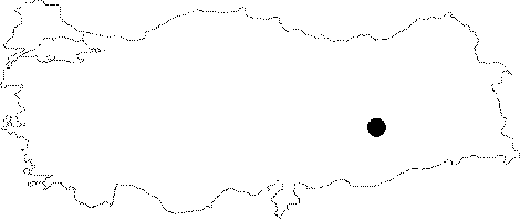 |
For photographs please click on the photo... 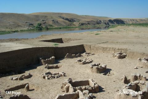 |
|
Type:
|
Mound |
|
Altitude:
|
490 m |
|
Region:
|
Southeastern Anatolia |
|
Province:
|
Diyarbakir |
|
District:
|
Bismil |
|
Village:
|
Yukari Salat |
|
Investigation Method:
|
Excavation |
|
Period:
|
|
|
|
|
 |
|
| Location: It is located 3 km south of Yukari Salat Beldesi; 3 km east of the district of Bismil in the province of Diyarbakir. Asagi Salat quarter of the Yukari Salat lies over the mound. The mound is on the bank of the Tigris River; 2 km east of the point where it joins the Salat stream. |
| Geography and Environment: The mound lies on an area fed by Tigris and its tributaries. Between Diyarbakir and Batman; the basin of Tigris is about 500 m high from the sea level. The road of Salat valley passes over Tigris in Asagi Salat and heads towards east and south. The mound; which lies beneath the quarter of Asagi Salat; measures about 150x100 m. It lies on a terrace that is about 3 m above the present river level. The cultural deposit of the site is about 5 m high in the middle section of the modern settlement. The southern section of the mound is destructed by the inundation of Tigris. |
| History: |
| Research and Excavation: It was first introduced by G.Algaze and his colleagues following the surveys conducted in the region in 1989. A more systematic survey was conducted by E. Ay in 1999 within the frame of the ODTÜ-TAÇDAM project [Senyurt 2002:672]. In 2000, salvage excavations were initiated under the direction of N. Inal, Director of Diyarbakir Museum and Y. Senyurt, academician at the History Department of the Gazi University within the content of the same project. It takes place in the registered archaeological sites list prepared by Ministry of Culture and Tourism. |
| Stratigraphy: The excavations included the areas so called Eastern Excavation Area, Central Excavation Area, Northeastern Sounding and Western Sounding. The Eastern Excavation Area yielded two levels dating to the Middle Age while three levels of same period were found in the Central Excavation Area. No artefacts were found in the Northeastern Sounding while stone foundations of the first level were unearthed in the Western Sounding Area. Under them lie graves dating to the Early Bronze Age at ca. 1.5 m deep from the surface. An Iron Age grave (M-29) was unearthed along with these graves at the trench V-14 and plan squares a-b/2-4 [Senyurt 2004:650]. It is the only find dating to the Iron Age unarthed during the excavations conducted in the site. |
| Small Finds: Grave: An Iron Age grave was exposed along with an EBA cemetery during the 2001 campaign. The trench V-14 and plan squares a-b/2-4 yielded a simple earth grave belonging to the Iron Age at the same level with EBA graves. Marked as M-29, the grave has been extremely destructed probably during a recent pit excavation for storing grains. Glass: The specimens of the horse rhyton in glass, which was found among the grave finds, are observed at Susa [Senyurt 2004:650]. |
| Remains: |
| Interpretation and Dating: The levels dating to the Middle Age which were exposed during the 2000 campaign at Asagi Salat are dated to the period when the Muslims started to dominate the region. Sherds and coins parallel to the ones found at Hasankeyf prove the presence of a settlement during the 11th-12th centuries at Asagi Salat. The most important outcome of the first excavations at Asagi Salat is the discovery of a cemetery dating to the beginning of EBA. The form and technical characteristics of the vessels recovered from the graves appear that they are continuation of the Late Uruk Period features. Depending on this data, it seems that the excavations at Asagi Salat will bring light to the connection between the Late Uruk and Early Dynastic Periods at Northern Mesopotamia [Senyurt 2002:679]. Other than these, levels dating to the Iron Age were also identified at the mound [Senyurt 2004:650]. |