|
©The Archaeological Settlements of Turkey - TAY Project
|
|
|
|
|
|
Akçahisar |
|
|
For site maps and drawings please click on the picture...  |
For photographs please click on the photo... 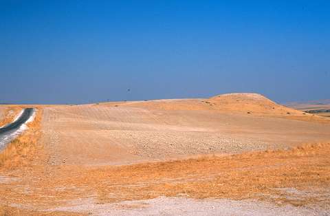 |
|
Type:
|
Mound |
|
Altitude:
|
600 m |
|
Region:
|
Southeastern Anatolia |
|
Province:
|
Sanliurfa |
|
District:
|
Merkez |
|
Village:
|
Büyük Ördek |
|
Investigation Method:
|
Survey |
|
Period:
|
|
|
|
|
 |
|
| It rests on the bench of the Incesu Stream, 2.3 km east of the Büyük Ördek Village, east of the Bozova District, northwest of Şanliurfa. Being far from the influence area of the Atatürk Dam, the small mound was discovered during a survey conducted by H. Kühne along the Incesu Valley in 1978. It is locally known as Gri Esk/Kurutepe. There is a terrace on the southwestern section. The material collected from the surface includes sherds from the Chalcolithic Age, Early Bronze Age, Middle Bronze Age, Iron Age, Byzantine and Islamic Periods. It is called Akçahisar (Hisar means fortress in Turkish) because of the fortified ruins resting on it. |
| Location: |
| Geography and Environment: |
| History: |
| Research and Excavation: |
| Stratigraphy: |
| Small Finds: |
| Remains: |
| Interpretation and Dating: |