|
©The Archaeological Settlements of Turkey - TAY Project
|
|
|
|
|
|
Borluk Deresi |
|
|
For site maps and drawings please click on the picture... 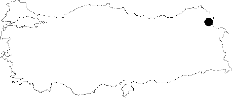 |
For photographs please click on the photo...  |
|
Type:
|
Single Findspot |
|
Altitude:
|
m |
|
Region:
|
Eastern Anatolia |
|
Province:
|
Kars |
|
District:
|
Merkez |
|
Village:
|
Borluk |
|
Investigation Method:
|
Survey |
|
Period:
|
OP |
|
|
|
 |
|
| Location: The name "Borluk Deresi"; is the collective name for all the sites that lie in the valley created by the Borluk Stream which begins at the village of Borluk; approximately 17-18 km southeast of Kars. It flows by the villages of Magaracik; Azatköy and Karacaören and empties into the Kars Stream southwest of this city. Archaeologically the sites of Borluk; Magaracik and Azatköy are each referred to separately; but because of their close resemblance; we have decided to collectively call these three sites the Borluk Deresi Vadisi sites (the Borluk Stream Valley sites) and to refer to them as a single unit. |
| Geography and Environment: The Borluk Stream; which springs from the northern fringes of Mount Borluk before it flows west in a narrow but deep valley; lies west of the town of Pazarcik. There are numerous rock-shelters and caves in this valley. Coarse-grained sand and pebbles have been deposited in the natural indentations at the base of this valley. Especially the G 50 map section of a 1:100;000 map shows many symbols representing caves in the region in and around the village of Magaracik. Kökten believes that these caves probably have archaeological importance. |
| History: |
| Research and Excavation: In 1942 during his survey of the Borluk Steam Valley; Kiliç Kökten collected chipped stone tools in three different sites in the province of Kars. The first site was scattered in the upper part of the stream; in the river bed itself and near the entrance to a cave in the village of Borluk. The second site is near the entrance of a cave in the village of Magaracik. The third site; close to the village of Azatköy; is in an area where Kökten conducted intensive research. In his report; Kökten mentions a small brook he calls the Magaracik Stream. It is possible that this is in fact the Koyunbasan Brook which empties into the Borluk Stream. Even though each of the three villages are only between 4 and 7 km away from each other; Kökten refers to each site as a separate entity. |
| Stratigraphy: |
| Small Finds: Kökten's surveys in the upper Borluk Stream near the village of Borluk yielded two side scrapers as well as a typical scraper point. Two of these tools; which the researcher classifies as Moustérien; were basalt and one was andesite. These chipped stone tools all have fluted ventral faces. The second site; near the village of Magaracik; is approximately 7 km from the first. The tools found at this site were also typical Moustérien type tools. An obsidian tool was found at the third site close to the village of Azatköy (also called Dündartepe); where the Borluk Stream Valley flows towards the village [Kökten 1944b:fig.XC; fig. 9]. This tool resembles the other tools found at the upper parts of the stream valley. All tools have been assigned to the Middle Palaeolithic. |
| Remains: |
| Interpretation and Dating: |