|
©The Archaeological Settlements of Turkey - TAY Project
|
|
|
|
|
|
Birtlan / Bögürtlen Höyük |
|
|
For site maps and drawings please click on the picture... 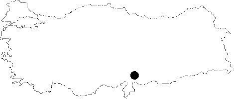 |
For photographs please click on the photo... 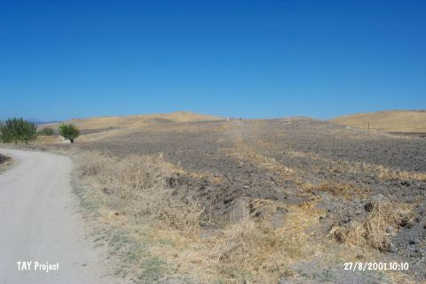 |
|
Type:
|
Mound |
|
Altitude:
|
600 m |
|
Region:
|
Mediterranean |
|
Province:
|
Gaziantep |
|
District:
|
Nurdagi |
|
Village:
|
Satirhöyük |
|
Investigation Method:
|
Survey |
|
Period:
|
Ceramic |
|
|
|
 |
|
| Location: This is a mound site located northwest of the city of Gaziantep and 9 km northeast of the town of Sakçagözü. Birtlan is a local derivative of the name Bögürtlen; literally meaning "blackberry". Both names are common in archaeological literature. The more correct version is Bögürtlen Höyük. |
| Geography and Environment: The 5-7 m high mound-site lies in the Sakçagözu Plain. There is a survey point on top of the mound. It is reported that basalt blocks were found at the surface of the mound in the 1961 survey [Perrot 1962:16]. |
| History: |
| Research and Excavation: A surface survey on the mound was conducted in 1948 by J. du Plat Taylor and in 1961 by J. Perrot. It takes place in the registered archaeological sites list prepared by Ministry of Culture and Tourism. |
| Stratigraphy: The stratigraphy has not been determined since no excavation was conducted. The surveys yielded monochrome prehistoric pottery as well as ceramics assigned to the Iron Age and the Roman Period. |
| Small Finds: Pottery: The gray and red burnished pot-sherds resemble those found in Coba Höyük/Sakçegözü; Layer I. |
| Remains: |
| Interpretation and Dating: With reservation; the pottery is believed to be contemporaneous with Amuq B affinities. In ASPRO the site has been assigned to the sixth phase and is dated to (uncalibrated) 7;600-7;000 BP. It is believed that the monochrome ceramics from the site are Late Chalcolithic; similar to those from the nearby site of Gedik Höyük [Hours et al. 1994:84]. |