|
©The Archaeological Settlements of Turkey - TAY Project
|
|
|
|
|
|
Dokuzhöyük |
|
|
For site maps and drawings please click on the picture...  |
For photographs please click on the photo... 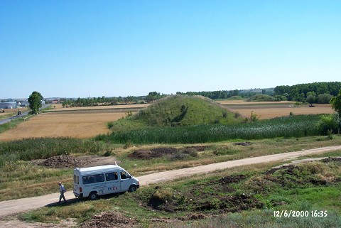 |
|
Type:
|
Tumulus |
|
Altitude:
|
49 m |
|
Region:
|
Marmara |
|
Province:
|
Kirklareli |
|
District:
|
Merkez |
|
Village:
|
Dokuzhüyük |
|
Investigation Method:
|
Survey |
|
Period:
|
|
|
|
|
 |
|
| The tumuli are located at the exit of the village of Dokuzhöyük; district of Merkez; province of Kirklareli. The village road passes in the middle of the area in the north-south direction. Seven tumuli were observed on the western side of the road and one on the eastern side. There is a wooded area to the west. It takes place in the registered archaeological sites list prepared by Ministry of Culture and Tourism. |
| Location: |
| Geography and Environment: |
| History: |
| Research and Excavation: |
| Stratigraphy: |
| Small Finds: |
| Remains: |
| Interpretation and Dating: |