|
©The Archaeological Settlements of Turkey - TAY Project
|
|
|
|
|
|
Agaçli |
|
|
For site maps and drawings please click on the picture... 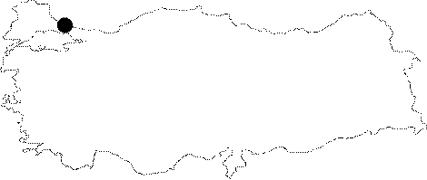 |
For photographs please click on the photo...  |
|
Type:
|
Habitation Site / Workshop |
|
Altitude:
|
20 m |
|
Region:
|
Marmara |
|
Province:
|
Istanbul |
|
District:
|
Kemerburgaz |
|
Village:
|
Agaçli |
|
Investigation Method:
|
Survey |
|
Period:
|
ÜP EP OP |
|
|
|
 |
|
| Location: This site is located approximately 30 km northwest of the city of Istanbul and 14 km northwest of the town of Kemerburgaz; on the sand dunes between the villages of Çiftealan and Agaçli. |
| Geography and Environment: The site is composed of several artifact scatters which are located along Agaçli Stream in the west; along Hakaydin Stream to the east; along the Black Sea coast to the north; and on the beach and shrub covered/forested sand dunes to the south. The area is approximately 1.5x1 km in size. Because the dunes by the shore occasionally shift as a result of the wind; older dunes with evidence of early campsite habitation are occasionally exposed (for more detail on the geographic setting of Agaçli see Harmankaya-Tanindi 1996:Agaçli). The survey code of this site is C 12 / 1. |
| History: |
| Research and Excavation: The first systematic surveys in this area began in 1973; after E. Fondakowsky's discovery of the site and M. Korfmann's (Istanbul German Archaeology Institute) notification of the University of Istanbul Faculty of Letters Prehistory Section. The crew accompanied by B. Howe and M. Korfmann was composed of students and faculty members from this department. In 1974 B. Howe analyzed the artifacts collected in this survey. As funding and opportunities permitted; students from this department continued to conduct surveys on these dunes. Most recently (in 1975 and 1980); Mehmet Özdogan; a member of the Prehistory Section surveyed the undamaged sections of the dunes as part of his comprehensive survey of Thrace. |
| Stratigraphy: |
| Small Finds: The small finds indicate that there were camp sites in Agaçli in the Middle; Upper and Epipalaeolithic [Özdogan 1983c:fig.2]. Analysis determining which period between the Middle Palaeolithic and the Epipalaeolithic each artifact scatter dates to has not yet been completed. Some scatters appear to be the remains of workshops. Such areas often include small flint nodules and have few tools. Blade technology is the most common; although Levalloiso-Moustérien flake tools and side scrapers have also been found [Özdogan 1985:222]. One of the artifact scatters with small blades and other geometric tools is similar to the finds from the shores of the northern Black Sea and to the Crimean Epipalaeolithic. Most of the artifacts from site were analyzed and published by I. Gastov and M. Özdogan. [Gastov-Özdogan 1994: 102-106; fig. 1-7]. |
| Remains: |
| Interpretation and Dating: |