|
©The Archaeological Settlements of Turkey - TAY Project
|
|
|
|
|
|
Beynam Çamlar |
|
|
For site maps and drawings please click on the picture... 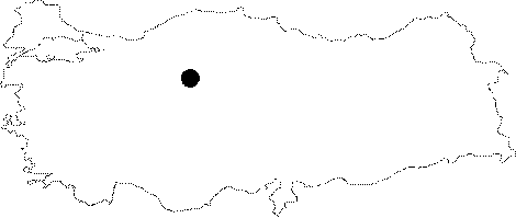 |
For photographs please click on the photo...  |
|
Type:
|
Single Findspot |
|
Altitude:
|
m |
|
Region:
|
Central Anatolia |
|
Province:
|
Ankara |
|
District:
|
Gölbasi |
|
Village:
|
Beynam |
|
Investigation Method:
|
Survey |
|
Period:
|
OP |
|
|
|
 |
|
| Location: This site is north of the 1517 m high Mount Kurukcu; near the Beynam Forest. The forest and the nearby village of Beynam are both approximately 36 km south of the city of Ankara. |
| Geography and Environment: Otubel Peak of Mount Kurucudag is one of the greener areas in the Ankara region. The Çam Stream which flows east of the village of Beynam before its confluence with the Adadere Stream springs from the north of this mountain. The region has abundant sources of water. |
| History: |
| Research and Excavation: A single chipped stone find has been recovered here by R. Peters. Further information on how and where this object was found is not provided. |
| Stratigraphy: |
| Small Finds: This chipped stone tool is a blade that was removed in the Moustérien technique with retouchings on its lateral edge. |
| Remains: |
| Interpretation and Dating: |