|
©The Archaeological Settlements of Turkey - TAY Project
|
|
|
|
|
|
Dülük Baba Tepesi |
|
|
For site maps and drawings please click on the picture...  |
For photographs please click on the photo... 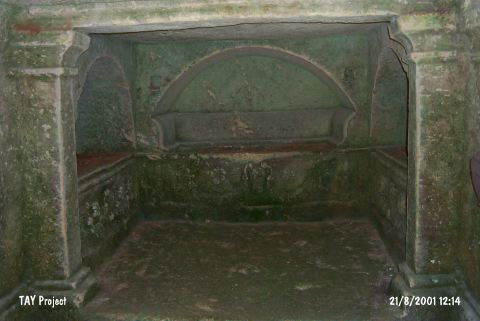 |
|
Type:
|
Sanctuary |
|
Altitude:
|
m |
|
Region:
|
Southeastern Anatolia |
|
Province:
|
Gaziantep |
|
District:
|
Merkez |
|
Village:
|
Dülük |
|
Investigation Method:
|
Excavation |
|
Period:
|
Late Iron Age |
|
|
|
 |
|
| Location: It is located in Dülük Village of Merkez District in Gaziantep Province. It remains within the range of the ancient city of Doliche. |
| Geography and Environment: |
| History: |
| Research and Excavation: It was discovered and documented during TAYEx 2001 Southeastern Anatolia region [TAYEx 21.9.2001]. The systematical researches in the sanctuary were initiated with the cooperation of Asia Minor Research Center and Gaziantep Museum in 2001. During the first two years, the aim of the study was to conduct a geological research. However, the results were not sufficient due to the disadvantages of the area (i.e woodland and high rocks). In 2003, the archaeological excavations were initiated in the summit of the area [http://www.doliche.de/tk/dueluek-baba-tepesi/arastirma-tarihi/, 08.12.15, 17:34]. |
| Stratigraphy: |
| Small Finds: Architecture: During the studies carried out between the years of 2006 and 2010, it was possible to determine the location of the center of IA and Hellenistic-Roman Period. The walls belonging to IA were unearthed. In Trench 11-01, a wall dated to the Late IA was exposed among the extensions of the foundation wall. 30 m of the wall belonging to the north-south extension was unearthed. In Trench 11-05, the excavations were initiated in order to expose the northwest corner of the Late IA enclosing wall. It was observed that the crushed stone masonry, which was discovered during the 2010 campaign carried out in Trench 11-02, is with a length of 7.5 m and a width of about 2.5 m. The wall was probably built for defence purposes. The construction technique of the wall indicates that the wall belongs to the Late IA [Blömer-Winter 2013]. During the 2013 excavations carried out in the Central Plato, it was not possible to follow the traces of IA walls due to destruction. As results of the study, it was revealed that the enclosing wall belonging to Early IA passes through the whole area. To the east of the wall, fills belonging to Late IA-Hellenistic Period were found. These fills yielded a great number of seals and beads [Blömer-Winter 2015:39]. During the 2014 studies, it was determined that Trench 14-03 enlarged Trench 13-02, which was excavated in the previous season, to the northwest of the central plato. The northwest corner of the enclosing wall Early Iron Age, which came from the east, continued to the west, and then continued to the south after 27 meters and continued for another 40 meters, was also exposed here. In parallel to the northern part of the wall, a foundation wall built with calcareous chipped blocks follows the wall. These remains show consistency with the foundation exposed in Trench 13-02 and Trench 11-02. These foundation remains have been in a connection since the 2nd century BC, the reconstruction of the sanctuary [Bölmer et al. 2016:45]. During the 2015 season, the wall remains exposed in the previous season were traced. In Trench 14-16, an oven made of tile and rubble stones with circular form was uncovered on the northeast corner of the area. Around it, a layer full of limestone and limestone fragments was exposed. This shows the existence of the temenos wall seated on the bedrock. The studies carried out in Trench 15-03 aimed to expose the continuation of the wall, 2.70 m length of which was uncovered in 2014. This wall adjacent to the temenos wall extends in the north-south direction. The studies show that the wall continues about 2.50 m and turns the east and forms a space. The width of the wall is 0.90 m and it is preserved up to 2.10 m in height. The preserved section of the wall show that it was built with four chipped stone blocks placed on top of each other. Two blocks on top function as connector and the ones at the bottom protrude forward and backward and it is believed that these blocks belong to the foundation. Under these blocks, bedrock was reached [Blömer et al. 2017:50-51, 54]. Pottery: The upper fill of the cistern found in Trench 11-06 contains IA sherds [Blömer-Winter 2013:363]. Metal: In Trench 11-01, a bronze statuette depicting a fawn was found and dated to the IA [Blömer-Winter 2013:362]. In addition, the area yielded stamp and cylinder seals belonging to the Late IA, scarabaei, fibulae and beads. These findings were used as votive goods [Blömer-Winter 2013:365]. During the 2014 studies, a bronze bull figurine was found in the fill of Trench 14-10 [Blömer et al. 2016:46]. Other: During the 2014 studies, a great number of small finds belonging to IA were found in the fill of the pit exposed in Trench 13-09. 50 stamp and cylinder seals were uncovered. As a result of the studies conducted so far, the number of the seals is reached to 660 in total [Blömer et al. 2016:44]. |
| Remains: |
| Interpretation and Dating: Dülük Baba Tepesi is one of the rare settlements in which the one can trace the continuity of the cult practices of the Northern Syria from IA to Roman Period. The potsherds and findings, especially the stele belonging to the mid IA, indicate that the sanctuary was used since the beginning of the 1st millenium BC [Blömer-Winter 2013:365]. |