|
©The Archaeological Settlements of Turkey - TAY Project
|
|
|
|
|
|
Beykisla |
|
|
For site maps and drawings please click on the picture...  |
For photographs please click on the photo... 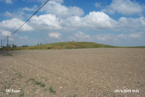 |
|
Type:
|
Mound |
|
Altitude:
|
880 m |
|
Region:
|
Central Anatolia |
|
Province:
|
Eskisehir |
|
District:
|
Seyitgazi |
|
Village:
|
Beykisla |
|
Investigation Method:
|
Survey |
|
Period:
|
Late |
|
|
|
 |
|
| The mound lies southeast of the city of Eskisehir; 10.5 km east-southeast of Seyitgazi; southeast of Beykisla (Feyziabad) Village. It is 800 m away from Beykisla on the road to Mecidiye village. On the left Bardakci Suyu passes 150 m east of the site. It is 5 m in height and 150 m in diameter. A surface collection was made by T. Efe and his team in 1994. There are many pits dug by illicit diggers. Late Chalcolithic Age and EBA 2-3 potsherds were found. It takes place in the registered archaeological sites list prepared by Ministry of Culture and Tourism. |
| Location: |
| Geography and Environment: |
| History: |
| Research and Excavation: |
| Stratigraphy: |
| Small Finds: |
| Remains: |
| Interpretation and Dating: |