|
©The Archaeological Settlements of Turkey - TAY Project
|
|
|
|
|
|
Dogu Ayranci |
|
|
For site maps and drawings please click on the picture...  |
For photographs please click on the photo... 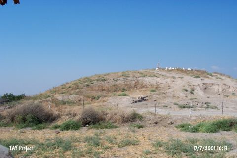 |
|
Type:
|
Mound |
|
Altitude:
|
200 m |
|
Region:
|
Mediterranean |
|
Province:
|
Hatay |
|
District:
|
Reyhanli |
|
Village:
|
Doguayranci |
|
Investigation Method:
|
Survey |
|
Period:
|
|
|
|
|
 |
|
| It lies in Doguayranci Village; north of Reyhanli District of Hatay Province. North of the mound stands the water reservoir of the village and to the east flows the Afrin Stream. The site was observed and documented during TAYEx 2001 Mediterranean region [TAYEx 17.7.2001]. |
| Location: |
| Geography and Environment: |
| History: |
| Research and Excavation: |
| Stratigraphy: |
| Small Finds: |
| Remains: |
| Interpretation and Dating: |