|
©The Archaeological Settlements of Turkey - TAY Project
|
|
|
|
|
|
Kinik Höyük |
|
|
For site maps and drawings please click on the picture...  |
For photographs please click on the photo... 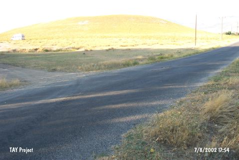 |
|
Type:
|
Mound |
|
Altitude:
|
1150 m |
|
Region:
|
Central Anatolia |
|
Province:
|
Nigde |
|
District:
|
Bor |
|
Village:
|
Bayat |
|
Investigation Method:
|
Excavation |
|
Period:
|
|
|
|
|
 |
|
| It lies 3.7 km northeast of Bayat Village; west-northwest of Bor District of Nigde Province. 2.3 km northeast of the mound passes Bor-Altunhisar motorway. The site was observed and documented during TAYEx 2002 Central Anatolia region [TAYEx 7.8.2002]. The settlement appears in the Nigde Culture Inventory which was achieved after the surveys organized by the Nigde Province Culture and Tourism Directorship in 2009. The mound is about 250-300 m in diameter and 35-40 m in height. The collected sherds from the surface are dated to EBA, IA, Hellenistic, Roman and Byzantine periods. |
| Location: It is located in Nigde Province, at the entrance of Altunhisar Valley on the skirt of Melendiz Mountains, in the northeast section of Konya Plain. |
| Geography and Environment: It is located at the foot of Mount Melendiz. The site consists of 20 m high mound with a diameter of 180 m. It is set on a terrace covering roughly 300 square meters. |
| History: |
| Research and Excavation: |
| Stratigraphy: |
| Small Finds: |
| Remains: |
| Interpretation and Dating: |