|
©The Archaeological Settlements of Turkey - TAY Project
|
|
|
|
|
|
Kerti Höyük |
|
|
For site maps and drawings please click on the picture...  |
For photographs please click on the photo... 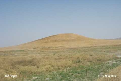 |
|
Type:
|
Mound |
|
Altitude:
|
1145 m |
|
Region:
|
Central Anatolia |
|
Province:
|
Karaman |
|
District:
|
Merkez |
|
Village:
|
Ekinözü |
|
Investigation Method:
|
Excavation |
|
Period:
|
|
|
|
|
 |
|
| It lies 3.5 km north of Ekinözü Village; northeast of Karaman Province. It extends in east-west direction and surrounded by fields. It was observed and documented during TAYEx 2002 Central Anatolia region [TAYEx 13.8.2002]. The excavation studies are being carried out by Karaman Provencial Directorate of Culture and Tourism and Selçuk University. The mound measures 250x150 m and 30 m in height. It is named Kerti (Derbe) Höyük. The mound yielded potsherds belonging to Bronze Age, Hellenistic, Roman and Byzantine Period [http://www.karamankulturturizm.gov.tr/yazdir?40975E03522E90C1B45498768D9E9D0F, 2.7.2016, 13:33]. |
| Location: |
| Geography and Environment: |
| History: |
| Research and Excavation: |
| Stratigraphy: |
| Small Finds: |
| Remains: |
| Interpretation and Dating: |