|
©The Archaeological Settlements of Turkey - TAY Project
|
|
|
|
|
|
Berberini |
|
|
For site maps and drawings please click on the picture...  |
For photographs please click on the photo... 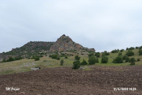 |
|
Type:
|
Flat Settlement |
|
Altitude:
|
1060 m |
|
Region:
|
Central Anatolia |
|
Province:
|
Eskisehir |
|
District:
|
Seyitgazi |
|
Village:
|
Kümbet |
|
Investigation Method:
|
Survey |
|
Period:
|
Late |
|
|
|
 |
|
| The site lies southeast of the city of Eskisehir; south-southwest of Seyitgazi District; on the rockies limiting the southern part of the valley; which is 2.5 km northwest of Kümbet village. The finds are secondary since it is understood that the soil; in which the finds are recovered by Efe; was brought here from a nearby flat-settlement for the construction of a ramp for the rock-cut chapel. Potsherds; flintstone tools and blade cores; dating back to the Late Chalcolithic Age were found in the soil. Some dark colored sherds are white paint decorated. The microlithic tools recovered south of the rocks strengthens the possibility of a flat-settlement in front of the rocks. The deposit of this layer was probably destroyed in the process of building the ramp. |
| Location: |
| Geography and Environment: |
| History: |
| Research and Excavation: |
| Stratigraphy: |
| Small Finds: |
| Remains: |
| Interpretation and Dating: |