|
©The Archaeological Settlements of Turkey - TAY Project
|
|
|
|
|
|
Aktopraklik |
|
|
For site maps and drawings please click on the picture...  |
For photographs please click on the photo... 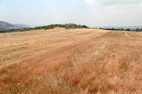 |
|
Type:
|
Mound |
|
Altitude:
|
146 m |
|
Region:
|
Marmara |
|
Province:
|
Bursa |
|
District:
|
Nilüfer |
|
Village:
|
Akçalar |
|
Investigation Method:
|
Excavation |
|
Period:
|
|
|
|
|
 |
|
| Location: It lies in the location called Akçalar Sirti; approximately 2 km east of Akçalar Town; west of Nilüfer District; southwest of Bursa Province. Aktopraklõk is situated at about 25 km west of the city of Bursa on one of the terraces rising gradually on the eastern edge of Uluabat Lake. The site is also known as Akçalar Sirti Höyügü. |
| Geography and Environment: The site takes place near the industrial area of Hasanaga. During the excavations it is observed that the upper layers have been damaged due to cultivation. Besides it is reported that Bursa-Izmir motorway is going to pass across this area. The mound is divided into three independent areas; the areas on top of the two elevations divided by the two stream catchment areas that extend towards the lake, and the slope of the southern elevation. Based on the data in hand all three areas are interrelated in terms of culture and chronology. The settlements that we named A, B and C are located at elevations which can hardly be differentiated by the naked eye [Karul 2008:65]. The settlement extends between two river beds and on the ridge north of one of these beds. All three sites (Aktopraklõk A-B-C) are built on Miocene bedrock, and Aktopraklõk C is situated on the north ridge mentioned. The settlement begins at the southern edge of the road linking Bursa, Akçalar, and Hasana a and was built in an east-west direction on a slightly sloping surface. Today the land is covered with olive trees and a number of test pits had been dug before the systematic excavations begun [Karul-Avcı 2011:2]. |
| History: |
| Research and Excavation: Salvage excavation started in 2004 by Necmi Karul from Istanbul University Prehistory Section. After 2005 season excavation; during the registration works made by Bursa Museum of Archaeology a Chalcolithic Age cemetery as found 100 m north of the mound and studies of this area was included to the fieldwork in 2006 [Karul-Özeren 2006:14]. It takes place in the registered archaeological sites list prepared by Ministry of Culture and Tourism. |
| Stratigraphy: The excavations on the upper cone of the mound were conducted in an area covering 450 squaremeters; in 5 trench units numbered as 15-16-17 H and 15-16 I. In the southern area 150 m south of the upper cone that has a rather flat surface only one trench was opened. In trench 30 L; in which the depth of a natural water channel formed by rain water was utilized; first the work was begun in a trench measuring 10x2 m and later this area was narrowed and deepened to 4x2 m. According to the preliminary analysis of the material; it is reported that the mound was first occupied in the Neolithic; rebuilt immediately after the Late Neolithic at the same location and continued during the First and Middle Chalcolithic periods. According to the researches in 2005 it was found that Aktopraklik Mound was founded on 3 mound areas which are interrelated in terms of chronology and close to each other. The pre-analysis of the ceramics finds and building remains revealed in the area B display similarities with the period V settlement which is situated in the same region. This level was dated to 5500-5400 BC after the calibrated measurements results. Although the the settlement date in area A was not verified the similarities of the ceramic specimens found in the area B suggest a settlement that was dated to the Early Chalcolithic Age [Karul 2008:71-72]. |
| Small Finds: Architecture: In trench 15 H; located to the northwest end of the excavation area on the upper cone; the remains of a burned structure and stone foundations were recovered immediately beneath the surface soil. To the northwestern corner of the trench; a stone foundation measuring 50 cm in width and consisting of two rows was found. Beneath this; a main wall and at least three rooms around it were determined. It is reported that the walls of the structure measures 40 cm thick and are covered with a limestone plaster that reaches up to 4 cm due to repetitions. It wes seen that the floor of the large room to the south of the main wall was covered with green colored loamy soil and then plastered with a mortar that includes limestone. On the northeastern corner of trench 16 H was found the remains of a rectangular structure measuring 5x9 m and traces of walls made with pise or piling technique. On the northeastern side of the structure the remains of a cupola furnace with a round plan measuring 1.3 m in diameter. In trench 16 H were determined 4 pits and based on the potsherds found in one of them it was dated to the Medieval Period. In one of the pits a skeleton and in another one prehistoric potsherds and small stones were found. Another pit; located to the west of the burial pit; measuring 1.3 m; was neatly surrounded and covered by large stones. When these stones were removed; numerous fragments of grinding stones were encountered and therefore it was decided that this could have been a votive pit. On the suotheastern corner of trench 17 H; a rectangular planned structure divided into two rooms was found. One of these rooms measures 3x3 m and is surrounded by stones. It is reported that the wall remains in this area have the same characteristics with the ones in trench 15 H. In trench 16 I; a ditch with two renewal phases covered with a thick layer of limestone was found. Trench 16I is the trench in which the ditch could be observed most properly. It is in the northeast-southwest direction and passes from the corner of trench 16 H and continues until the western profile of trench 17 H. In trench 17 H; 4 stake holes measuring 30 cm in diameter and continuing parallel to the outer side of the ditch were determined. The limestone coating belonging to the northern side of the ditch was recovered on the southwestern corner of trench 15 H and was determined to be passing from the northwestern corner of trench 16 H; sticking into the ground with a slight slope to the south and continuing out of the excavation area to the west. The stone foundation of a rectangular structure was recovered immediately beneath the surface of trench 15 I. On the northeastern corner of corner of trench 30 L were encountered the remains of a wall made of pretty large stones. In some parts the thickness of the wall reaches up to 1.5 m in 4 rows of stones. Due to the limited area of excavation; the complete plan of the wall was not determined; but according to the size and arrangement of the stones it is suggested that it might belong to an enclosure system. In the deeper part of trench 30 L; a trench with a half width of 3.5 m and 30 degree angle was recovered and reached until the base. The ditch; measuring about 1.5 m in depth; cuts across a settlement deposit of at least 3 layers and 40 cm depth; and the settlement has and archaeological deposit of 2 m in this area. It was also determined that the surface of bedrock was partly leveled and dug; and the earliest level of the mound was reached. Researches in 2005: Aktopraklik Area A: Due to the foundation of this part of the settlement which was given this name, possibly on the bank of a dried out stream which extended to Lake Ulubat, the land was covered partially with 1 m high debris brought by the stream, therefore finding archaeological material on the surface of the land is almost impossible. According to the geomagnetic measurements the area A settlement was spreaded onto a land at least of 150x150 m in dimensions. The soundings show that the depth of the archaeological culture fill is at least 2.2 m. The revealed remains consists only of a ditch and the two massive walls that extend in parallel. Based on the measurement results the ditch has a diameter of 65 m. The banks of the ditch make a 30 degree angle, and connect to each other after leveling. The opening of the ditch is 6 m wide. It is 2 m deep and it reaches the bedrock at that depth. The fill within the ditch consist of crumbs of burnt adobe at the top, and as it goes deeper there are burnt adobe blocks. Most of the adobe blocks contain traces of tree branches and wood, and this gives the impression, that these belong to building walls. Although made within a narrow area the surface of the bedrock under the ditch was partially leveled and at some locations round and shallow pits were dug. There is a stone wall built in parallel to the ditch on the inside edge of the ditch. This wall was possibly built at the same time and along with the ditch, and it bears a function such as supporting the surrounding system. Besides the ditch there are two stone walls out of which, one is tangent to the ditch. The walls which extend in northeast-southwest direction constitute a very regular line. Stones that measure 1.5x2 m were used on both walls' southern sides. The sides of these walls that face outside were corroded possibly due to water. The back sides of the walls were supported by mid-size stones which measure approximately 2 m in width. The homogenous soil fill in the 10 m wide area between the two walls was elevated to the level of the walls, and at some parts it even covers the walls [Karul 2008:65-67]. In 2007, in Area A the moat or ditch investigated last year was found to have a stone construction beside it. The broad stone scatter forms two parallel rows aligned with the ditch. They were probably retaining walls and perhaps were also used to direct water flow [http://cat.une.edu.au/page/aktopraklik; 16.11.2009, 12:16]. The Area B of Aktopraklik which is 100 m north of Area A was founded on the skirt of a presently small forest of oaks and was spreaded onto an area of 150x150 m based on the dispersion of the survey finds. Based on the sounding results the soil fill is approximately 2.5 m deep. At this location a large ditch was coincided and as a result of the measurements the ditch is approximately 100-130 m wide. The upper opening of the ditch is about 11 m and the sides of the ditch were renovated many times and during the first three phases it was plastered by a few centimeters thick of limestone, afterwards a green and thick plaster was used. The calcerous plaster continues on the surface, in the shape of a band, which reaches a width of 2 m from the edges towards outside. At some locations a thick level of soil laid between the renovation phases was observed. This practice suggests that the ditch surface was leveled at necessary places by laying a soil layer during the renovation process. The fact that there are remains of a hearth at the top level of the ditch shows that this area was used for other purposes as well after its function as a ditch was over [Karul 2008:67]. A settlement structure was coincided at area B within and outside the area surrounded by the ditch, which extends in parallel to the ditch. Thes buildings which were unearthed right below the surface soil are in near square plan placed in northeast-southwest direction. Although not burnt the difference in the color of the soil and the plaster of the walls the buildings can be differentiated, and these cover an area of 35 m2 in size. The southern walls of the buildings make standart extraverted profile at the center by 35 cm. It was found that wooden girders were used in the construction of adobe brick walls. All the surfaces of the internal walls were plastered by calcerous mortar and this process was repeated several times. All the walls contain buttresses that extend towards inside the building. These reach a length of approximately 90 cm, and possibly bear the function of supporting the roof or the upper storey, and in the mean time they separate the building into rooms. Thus there is a kiln on one of the northwestern corners of one of the buildings. The kiln is about 30 cm above the ground and it was also plastered by a calcerous mortar. The buildings in the same plan extend out of and in parallel with the ditch. The floor level of the buildings at this place could not be found yet but the preserved wall heights have reached 1 m. Within one the buildings where a certain depth was reached burnt debris was found following a thick green sterile clay fill. This explains the reason why the walls could be preserved at this height. It also suggests that the buildings were buried the way the humans were. It demonstrates the fact that the practice known in the Near Eastern or Central Anatolien Neolithic settlements extends to Northwestern Anatolia [Karul 2008:68-69]. Walls where the stones were rarely used were confronted in the second excavation area 40 m north of the trenches that increase at and around the ditch at the upper mound section. Building remains where wood and adobe were used are underneath these remains. Two adjacent buildings were revealed with patios in front of them. Out of these buildings one has a rectangular and basic plan, the one in the west has remarkable walls. The building founded in east-west direction measures7.5x5.5 m. The walls have thicknesses between 60-70 cm and cover a rectangular area and these have a remarkable plan due to its long buttresses that extend towards the center of the building, its profiles, and niches. The opening in the center of the northern wall with buttresses on both sides constitute the entrance of the building. At this building as well the western wall makes an approximate 50 cm profile at the center. There are also remains of a kiln with a dome on top. The internal surfaces of the walls were plastered by a green clay of 3-4 cm in thickness, and 2 cm thick calcerous mortar. The fact that no white color calcerous plaster traces on the external surfaces of the building were found as it was on the other buildings can be interprested as the rain drops that fell on the wall skirts or that flowed from the roof splashed and caused the plaster to dissolve. Horizontal wooden beams were found at the cross-sections of the walls which constitute the southeastern corner of the building. The fact that other wooden elements were also found at the intersection where the 2.5 m long beams meet suggests that the floor was covered with wood. This thesis is confirmed by the continuity of the course of walls over these wooden elements. Out of the walls which collapsed the same way, in extraverted direction all were constructed with adobe bricks connected by calcerous mortar which was also used as plaster. Another building element that was partially revealed in the excavaion area belongs to a ditch structure. One edge of the ditch which can be observed on the south of the above mentioned buildings has a declined and plastered surface as in the other buildings [Karul 2008:69-70]. Area C of Aktopraklik, is situated on the crest right north of area B. Due to the tree roots in the ground, the destruction by the Roman settlement and the large amount of soundings the characteristics of the culture soil could not be identified. But some building remains were encountered. Two of these are circular paved stones [Karul 2008:71]. In Area B the upper level has houses that look as if they were used on a seasonal basis. The level below has better preserved square structures with mud brick walls, internal niche or buttress, posts for roof support and platforms. In 2007, there were many more household finds [http://cat.une.edu.au/page/aktopraklik; 16.11.2009, 12:16]. Ceramics: 2 storage jars were found in-situ on the limeztone covered floor of trench 15 H. Finds such as ceramics and sling shots that were extremely effected by second burn found within the culture soil at Area A in 2005, were covered by a calcer [Karul 2008:66]. Inside the 10 m wide area between the two walls at area B a very homogenous soil fill was encountered. Within the culture soil sherds were found. The vessels are in general lead grey, dark brown, thin rimmed and elaborately made. Among these there are also specimens with short necks, spheric bodies, and bowls with small mounts and long strap handles. The presence of stirrup jars on some specimens is remarkable. Most of the elements were decorated by chisel decorations filled with a white paste filling inside. The decorations were mostly applied on the upper section between the neck and body of the vessels. Among the widely used decorations there are triangles filled with diagonally drawn lines, shading type of consecutive lines and small dents drawn on both sides of a straight line that reminds the wheat motif [Karul 2008:68]. Brown and lead-black spheric vessels with thick walls and short necks were found in the buildings revealed in the environs of the ditch inside the area B. The vessels bear rarely deep consecutive wavy lines on the surfaces. Both the general idea of vessel forms and their decorations show similarities with the Ilipinar V period in the southern Marmara Region. The ceramics found in Area C of Aktopraklik consist of basic "S" profiled plain vessels with large handles. Besides the vessels in light brown tones the box shaped vessels also are the similar specimens of the vessels found in Ilıpınar X period and Fikirtepe [Karul 2008: 71]. Clay: Approximately thousand sling shots were found [Karul 2006:132]. Human Remains: A partly damaged skeleton was recovered from one of the pits in trench 16 H. The burial; which belongs to an adult female; was placed in hocker position and its legs were damaged afterwards. There is a Chalcolitic Age cemetery on the ridge immediate north of the site. Some pits and burials were found within the ditch at Area B of Aktopraklik during the researches in 2005. Out of the 3 burials two were laid in hocker position on the ground plastered with a calcerous mortar which was also used to plaster the edges of the ditch [Karul 2008:68]. Following the soundings performed for a factory construction permit by the Museum of Archaeology of Bursa in 2005 at Aktopraklık C area many skeletons and archaeological material was coincided. The soundings of 2006 also revealed bones that belonged to 4 individuals and hocker type buried skeletons [Karul 2008:71]. Other: The finds belonging to the Chalcolithic Age include spatula; awl; bone bead; stone female figurine; flat axe; marble ring fragment; the handle of a bone spoon; and beads. These finds have not been published in detail yet. Limestone beads, spatulas, and pin type of bone tools were found in addition to a large amount of sling shots inside the buildings revealed at area B around the ditch in 2005 [Karul 2008:69]. |
| Remains: |
| Interpretation and Dating: In the mound of Akçalar Sirti was recovered a settlement surrounded by two ditch systems; one on the upper cone measuring 100 m and the other in the southern excavation are measuring 70 m. It is reported that the ceramics found especially in the upper part of the settlement; in the deposit identified as Layer 1; were not encountered in the other sites of the region but has similarities with the Central Aegean sites such as Orman Fidanligi; Höyücek and Demircihöyük. The assemblage also includes bone spoon and spatula; which are typical finds of Marmara Region and Thrace Neolithic settlements. Akçalar Sirti also has similarities with Ilipinar; which is the nearist prehistoric settlement. However; finds which are not recognized from Ilipinar were encountered in Akçalar Sirti. Considering this preliminary information; it is believed that the mound is of great significance for the prehistory of northeastern Anatolia. 2005 season fieldwork shows that the newest layer of the mound is dated to Ilıpinar VA period; middle of 5th millennium BC; depending on the analogies of the finds. There are no 14C analyses confirming these results yet [Karul-Özeren 2006:14] During the researches in 2005 Inside the 10 m wide area between the two walls at area B outside the ditch, a very homogenous soil fill was encountered. Within the culture soil sherds were found. Although two walls were erected on both sides of this soil can help reveal the date for the formation process of the culture soil, the fact that the sherds were not corroded, supports the interpretation that this soil filling possibly derived due to some kind of water flow, which happened very fast. The construction of these massive walls necessitates an organized work power and this suggests a necessity that can not be answered by simpler solutions. Since there is not enough data it is assumed that these walls which are in parallel with the ditch were part of a gradual embankment to prevent the overflow of flood waters caused by a water source in the region. Thus the topography at this section lowers towards the Ulubat Lake by a steep declination [Karul 2008:66-67]. |