|
©The Archaeological Settlements of Turkey - TAY Project
|
|
|
|
|
|
Aktopraklik |
|
|
For site maps and drawings please click on the picture...  |
For photographs please click on the photo... 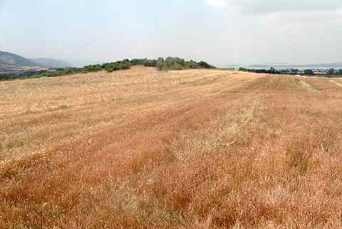 |
|
Type:
|
Mound |
|
Altitude:
|
146 m |
|
Region:
|
Marmara |
|
Province:
|
Bursa |
|
District:
|
Nilüfer |
|
Village:
|
Akçalar |
|
Investigation Method:
|
Excavation |
|
Period:
|
|
|
|
|
 |
|
| Location: It lies in the location called Akçalar Sirti; approximately 2 km east of Akçalar Town; west of Nilüfer District; southwest of Bursa Province. Aktopraklõk is situated at about 25 km west of the city of Bursa on one of the terraces rising gradually on the eastern edge of Uluabat Lake. The site is also known as Akçalar Sirti Höyügü. |
| Geography and Environment: The site takes place near the industrial area of Hasanaga. During the excavations it is observed that the upper layers have been damaged due to cultivation. Besides it is reported that Bursa-Izmir motorway is going to pass across this area. The mound is divided into three independent areas; the areas on top of the two elevations divided by the two stream catchment areas that extend towards the lake, and the slope of the southern elevation. Based on the data in hand all three areas are interrelated in terms of culture and chronology. The settlements that we named A, B and C are located at elevations which can hardly be differentiated by the naked eye [Karul 2008:65]. The settlement extends between two river beds and on the ridge north of one of these beds. All three sites (Aktopraklõk A-B-C) are built on Miocene bedrock, and Aktopraklõk C is situated on the north ridge mentioned. The settlement begins at the southern edge of the road linking Bursa, Akçalar, and Hasana a and was built in an east-west direction on a slightly sloping surface. Today the land is covered with olive trees and a number of test pits had been dug before the systematic excavations begun [Karul-Avcı 2011:2]. |
| History: |
| Research and Excavation: Aktopraklõk was discovered in 2002 when a team from the Prehistory Department of Istanbul University made a survey in the area where an industrial center had been planned [Karul-Avcı 2011:1]. Salvage excavation started in 2004 by Necmi Karul from Istanbul University Prehistory Section. After 2005 season excavation; during the registration works made by Bursa Museum of Archaeology a Chalcolithic Age cemetery as found 100 m north of the mound and studies of this area was included to the fieldwork in 2006 [Karul-Özeren 2006:14]. It takes place in the registered archaeological sites list prepared by Ministry of Culture and Tourism. |
| Stratigraphy: The excavations on the upper cone of the mound were conducted in an area covering 450 squaremeters; in 5 trench units numbered as 15-16-17 H and 15-16 I. In the southern area 150 m south of the upper cone that has a rather flat surface only one trench was opened. In trench 30 L; in which the depth of a natural water channel formed by rain water was utilized; first the work was begun in a trench measuring 10x2 m and later this area was narrowed and deepened to 4x2 m. According to the preliminary analysis of the material; it is reported that the mound was first occupied in the Neolithic; rebuilt immediately after the Late Neolithic at the same location and continued during the First and Middle Chalcolithic periods. |
| Small Finds: Architecture: In trench 15 H; located to the northwest end of the excavation area on the upper cone; the remains of a burned structure and stone foundations were recovered immediately beneath the surface soil. To the northwestern corner of the trench; a stone foundation measuring 50 cm in width and consisting of two rows was found. Beneath this; a main wall and at least three rooms around it were determined. It is reported that the walls of the structure measures 40 cm thick and are covered with a limestone plaster that reaches up to 4 cm due to repetitions. It wes seen that the floor of the large room to the south of the main wall was covered with green colored loamy soil and then plastered with a mortar that includes limestone. On the northeastern corner of trench 16 H was found the remains of a rectangular structure measuring 5x9 m and traces of walls made with pise or piling technique. On the northeastern side of the structure the remains of a cupola furnace with a round plan measuring 1.3 m in diameter. In trench 16 H were determined 4 pits and based on the potsherds found in one of them it was dated to the Medieval Period. In one of the pits a skeleton and in another one prehistoric potsherds and small stones were found. Another pit; located to the west of the burial pit; measuring 1.3 m; was neatly surrounded and covered by large stones. When these stones were removed; numerous fragments of grinding stones were encountered and therefore it was decided that this could have been a votive pit. On the suotheastern corner of trench 17 H; a rectangular planned structure divided into two rooms was found. One of these rooms measures 3x3 m and is surrounded by stones. It is reported that the wall remains in this area have the same characteristics with the ones in trench 15 H. In trench 16 I; a ditch with two renewal phases covered with a thick layer of limestone was found. Trench 16I is the trench in which the ditch could be observed most properly. It is in the northeast-southwest direction and passes from the corner of trench 16 H and continues until the western profile of trench 17 H. In trench 17 H; 4 stake holes measuring 30 cm in diameter and continuing parallel to the outer side of the ditch were determined. The limestone coating belonging to the northern side of the ditch was recovered on the southwestern corner of trench 15 H and was determined to be passing from the northwestern corner of trench 16 H; sticking into the ground with a slight slope to the south and continuing out of the excavation area to the west. The stone foundation of a rectangular structure was recovered immediately beneath the surface of trench 15 I. On the northeastern corner of corner of trench 30 L were encountered the remains of a wall made of pretty large stones. In some parts the thickness of the wall reaches up to 1.5 m in 4 rows of stones. Due to the limited area of excavation; the complete plan of the wall was not determined; but according to the size and arrangement of the stones it is suggested that it might belong to an enclosure system. In the deeper part of trench 30 L; a trench with a half width of 3.5 m and 30 degree angle was recovered and reached until the base. The ditch; measuring about 1.5 m in depth; cuts across a settlement deposit of at least 3 layers and 40 cm depth; and the settlement has and archaeological deposit of 2 m in this area. It was also determined that the surface of bedrock was partly leveled and dug; and the earliest level of the mound was reached. The chronological sequence of Aktopraklõk C can be at least divided into two sub-cultural stages. The earliest structural remains of the settlement established directly on virgin soil comprise of several rows of stones with a circular plan. These remains are located in close proximity to each other in the southern section. Two constructions built at about 1 m from each other are an irregular, single row of stones of about 1 m in diameter, and a similar one just south of the first constitute the architectural remains from this period. The southernmost structure was also constructed with a single row of stones, but its diameter is at least 1.5 m. Throughout the whole excavated area traces of a second stage were ncountered. Similar to the earlier level, this stage shows courtyards paved with small stones. Vestiges of 5 structures have so far been found which in spite of small differences were constructed with a similar technique. Although no traces of postholes were noted on the borders of these structures which had a diameter between 3-6 m, we assume that the superstructures consisted of a framework of wooden posts and branches interlinked in a wattle-and-daub manner. In three of the structures the wall bases were built with stone courses. It appears that theses stone courses were usually constructed along half of the diameter of the structure, while the other half was left open to the elements. In the remaining two structures no regular stone courses were noticed. These structures are characterized by concave floors which were dug directly in the soil. One of these structures displays a floor which is better preserved than others. The edges descend with a slight slope and reach a depth of 40 cm in the center; it was hollowed in the bedrock and shows stages of restoration. In another structure the floor consisted of bedrock which was paved with small stones. The depth of the hollowed floor of this structure also reaches ca. 40 cm. There are ovens in three structures whose borders are relatively better preserved. These ovens, built close to the wall, are dome-shaped and have a diameter of ca. 60 cm. [Karul-Avcı 2011:1-15]. Pottery: 2 storage jars were found in-situ on the limeztone covered floor of trench 15 H. The Neolithic pottery of Aktopraklõk C as in other settlements of the region is characterized by monochrome wares. Different shades of brown and red wares constitute the majority, but the percentage of the cream and beige-colored wares in lower levels of the Neolithic Period in Aktopraklõk C, which are frequent in the mounds of Mentese (Roodenberg et al., 2003: 39) and Barcin, cannot be underestimated. This type of pottery constituted a small percentage at Fikirtepe and Pendik (Ozdogan, 1979: 208-209), but was more intensively used in the early stages of the Fikirtepe Culture. Black wares which are characterized by their form or surface treatment and appeared in the later stages of the Fikirtepe Culture, constitute a small group in Aktopraklõk C. This ware group, well-known from the Fikirtepe, has a good paste, is well polished and usually thin-walled. The black wares are found in small numbers in Aktopraklõk C, their surface treatment is not as qualified as in Fikirtepe, but there are thin-walled examples similar to those from Fikirtepe and Pendik. Mention should be made also of a subgroup among the black wares having black slip but no polish; this is another type without parallels among the Fikirtepe pottery. Red pottery sherds make up another large group in Aktopraklõk C and indicate diversity in the pottery corpus. The red wares were used intensively in all settlement layers. There are the wares of good quality, bright red color, thin-walled, and well polished, a group consisting of unpolished examples having a gritty paste, and another group whose sand-contained surface is left coarse. Curved S-shape bowls constitute the fine quality group among the red wares, while the main form for both the coarse, sand-tempered and the polished wares with gritty surfaces are vessels with thin restricted rims. Such rims are generally found on pots, called holemouths; these pots also have large horizontal handles fixed on the belly or between the belly and the rim. These handles are observed quite often on pottery vessels from the Pendik excavations of 1981 (Ozbasaran, 1989: 14), and it is possible that they occurred more frequently in the Archaic stage of the Fikirtepe Culture. In addition to holemouth pots and S-shape bowls there is another type group in Aktopraklõk C: flat sided simple pots. Perforated tubular and crescent-shaped handles occur on all forms, while horizontal handles are usually found on holemouth pots. Apart from pot and bowl types, the assemblage also includes boxes, often called cult tables. These boxes, generally square but also more rarely triangular, usually have well polished surfaces provided with incised, normally geometric line motifs as was observed in the other settlements belonging to the Fikirtepe Culture (Schwarzberg, 2009: 167ff). Another noticeable difference in Aktopraklõk C is the presence of the decorative surface treatment such as the excised decorations with white incrustation known from Pendik (Ozdogan, 1983). Decorative patterns characteristic for the developed stages of the Fikirtepe Culture (Ozdogan, 2007: 413) are only noticed on cult tables in Aktopraklõk C. The impresso decoration from phases IX and VIII of Ilõpõnar (Thissen, 2001: 40) has parallels in Aktoprakl k's Neolithic period only. Similarly, collared vessels rather common in the developed Fikirtepe phases constitute another pottery shape that precedes Aktopraklõk C [Karul-Avcı 2011:4]. Human Remains: A partly damaged skeleton was recovered from one of the pits in trench 16 H. The burial; which belongs to an adult female; was placed in hocker position and its legs were damaged afterwards. About 50 burials were uncovered in systematic excavations, while skeletal fragments from 14 humans had been previously collected in the soundings made by the Bursa Museum. A dozen were found in Aktoprakl k B, all from the Early Chalcolithic period, and almost three dozens in the cemetery belonging to the Late Neolithic and Early Chalcolithic periods. The idea of burial within the settlement, which is characteristic for the Neolithic Period, was abandoned in the Chalcolithic Period as the concept of a 'city of the dead' replaced the tradition of living with the dead. The burials of Aktopraklik C, spread over an area of 1400 sqm, were primarily close to the surface and had been affected by medieval construction and modern agriculture. Aside from some exceptions each individual had his own grave and was often accompanied with grave goods, mostly pottery vessels placed near the head or feet and limestone beads from necklaces and marble bracelets. Despite the generally bad preservation of the burials the study of the humyielded sometimes a detailed view of the inhabitants [Karul-Avcı 2011:7]. Other: The finds belonging to the Chalcolithic Age include spatula; awl; bone bead; stone female figurine; flat axe; marble ring fragment; the handle of a bone spoon; and beads. These finds have not been published in detail yet. |
| Remains: |
| Interpretation and Dating: In the mound of Akçalar Sirti was recovered a settlement surrounded by two ditch systems; one on the upper cone measuring 100 m and the other in the southern excavation are measuring 70 m. It is reported that the ceramics found especially in the upper part of the settlement; in the deposit identified as Layer 1; were not encountered in the other sites of the region but has similarities with the Central Aegean sites such as Orman Fidanligi; Höyücek and Demircihöyük. The assemblage also includes bone spoon and spatula; which are typical finds of Marmara Region and Thrace Neolithic settlements. Akçalar Sirti also has similarities with Ilipinar; which is the nearist prehistoric settlement. However; finds which are not recognized from Ilipinar were encountered in Akçalar Sirti. Considering this preliminary information; it is believed that the mound is of great significance for the prehistory of Northeastern Anatolia. 2005 season fieldwork shows that the newest layer of the mound is dated to Ilıpinar VA period; middle of 5th millennium BC; depending on the analogies of the finds. There are no 14C analyses confirming these results yet [Karul-Özeren 2006:14]. Aktopraklik belongs to a settlement category called Flachsiedlung. In prehistoric Europe this was a widespread form of settlement that can be contrasted to Anatolia and the Near East where tell sites are common. As can be observed at Aktopraklk, long lasting occupation Ğ continuous or interrupted Ğ in flat settlements is expressed by spatial extention rather than by the accumulation of habitation levels at one spot. Aktopraklik constitutes a good example of this type of settlement where juxtaposition and relocation at some distance from the original site location occurred. The Neolithic occupation came to an end at Aktopraklik C when the dwelling quarters moved 100m to the south; that new residence is called Aktopraklõk B. From then onwards site C was merely used as a cemetery [Karul-Avcı 2011:7]. |