|
©The Archaeological Settlements of Turkey - TAY Project
|
|
|
|
|
|
No Name (Ayranci / Bögecik) |
|
|
For site maps and drawings please click on the picture...  |
For photographs please click on the photo... 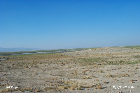 |
|
Type:
|
Mound |
|
Altitude:
|
1060 m |
|
Region:
|
Central Anatolia |
|
Province:
|
Karaman |
|
District:
|
Ayranci |
|
Village:
|
Bögecik |
|
Investigation Method:
|
Survey |
|
Period:
|
|
|
|
|
 |
|
| It is situated in the quarter of Savran; which was formerly known as Düden; on the road between the villages of Bögecik and Ambar; in the Ayranci District of Karaman Province. It is a small mound. There is a cemetery on the western side of the mound. Therefore it is called Mezarlik Höyük by the villagers. On the north of the mound there is a lake called Akgöl which is drained today. It was observed and documented during TAYEx 2002 Central Anatolia region [TAYEx 11.8.2002]. |
| Location: |
| Geography and Environment: |
| History: |
| Research and Excavation: |
| Stratigraphy: |
| Small Finds: |
| Remains: |
| Interpretation and Dating: |