|
©The Archaeological Settlements of Turkey - TAY Project
|
|
|
|
|
|
No Name (Merkez / Inandik) |
|
|
For site maps and drawings please click on the picture...  |
For photographs please click on the photo... 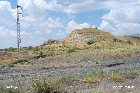 |
|
Type:
|
Flat Settlement |
|
Altitude:
|
830 m |
|
Region:
|
Central Anatolia |
|
Province:
|
Çankiri |
|
District:
|
Merkez |
|
Village:
|
Inandik |
|
Investigation Method:
|
Survey |
|
Period:
|
|
|
|
|
 |
|
| The mound lies immediately northwest of Hacibey Bridge; 6 km southwest of Inandik Village; south of Çankiri. This location; where Inandik Vase was found locally known as Han and soil was taken from here by bulldozer in 1962. It was observed and documented during TAYEx 2002 Central Anatolia region [TAYEx 16.7.2002]. |
| Location: |
| Geography and Environment: |
| History: |
| Research and Excavation: |
| Stratigraphy: |
| Small Finds: |
| Remains: |
| Interpretation and Dating: |