|
©The Archaeological Settlements of Turkey - TAY Project
|
|
|
|
|
|
No Name (Merkez / Büyükördek) |
|
|
For site maps and drawings please click on the picture...  |
For photographs please click on the photo... 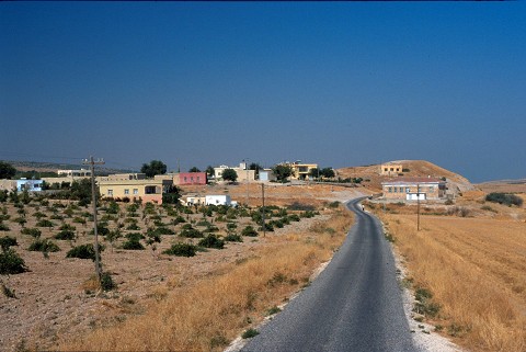 |
|
Type:
|
Mound |
|
Altitude:
|
500 m |
|
Region:
|
Southeastern Anatolia |
|
Province:
|
Sanliurfa |
|
District:
|
Merkez |
|
Village:
|
Büyükördek |
|
Investigation Method:
|
Survey |
|
Period:
|
|
|
|
|
 |
|
| The mound is located in village of Büyükördekçi of Sanliurfa province which is 11 km away from Sanliurfa-Hilvan motorway. The water reservoir of the village is built on top of the mound. A paved road passes immediately northeast and Incesu stream runs east of the mound. The mound has a height of 15 m. A dirt road cuts east-northeast skirt of the mound. There are houses on top and a fountain east of the mound. It was observed and documented during TAYEx 2001 Southeastern Anatolia region [TAYEx 4.9.2001]. |
| Location: |
| Geography and Environment: |
| History: |
| Research and Excavation: |
| Stratigraphy: |
| Small Finds: |
| Remains: |
| Interpretation and Dating: |