|
©The Archaeological Settlements of Turkey - TAY Project
|
|
|
|
|
|
Çörten |
|
|
For site maps and drawings please click on the picture...  |
For photographs please click on the photo... 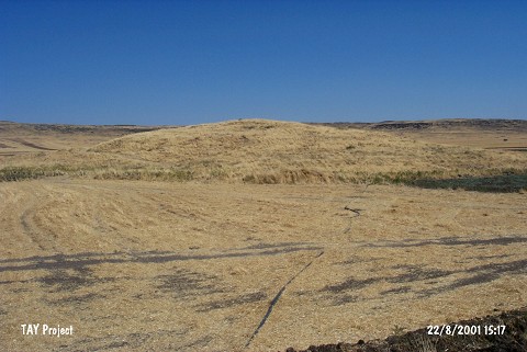 |
|
Type:
|
Mound |
|
Altitude:
|
710 m |
|
Region:
|
Southeastern Anatolia |
|
Province:
|
Kilis |
|
District:
|
Merkez |
|
Village:
|
Çörten |
|
Investigation Method:
|
Survey |
|
Period:
|
|
|
|
|
 |
|
| The site lies in Çörten village of Kilis province. It is located west-southwest of the village and 500 m southeast of Gaziantep-Kilis highway. The mound is surrounded by fields and there are piled up soil hills formed because of digging wells on its south slope. The mound is close to the crescent hills at the southeast end of the plain which its located in. It is approximately 10 m high and there is a survey point on top. The site has been discovered by a team conducted by E. Özgen during the survey in 2000 and pottery sherds belonging to Ceramic Neolithic and Ubaid Period were collected from the mound. Also it was reported that mosaics and walls made of basalt had been seen around the mound. It takes place in the registered archaeological sites list prepared by Ministry of Culture and Tourism. |
| Location: |
| Geography and Environment: |
| History: |
| Research and Excavation: |
| Stratigraphy: |
| Small Finds: |
| Remains: |
| Interpretation and Dating: |