|
©The Archaeological Settlements of Turkey - TAY Project
|
|
|
|
|
|
Aratepe / Koskinia |
|
|
For site maps and drawings please click on the picture...  |
For photographs please click on the photo... 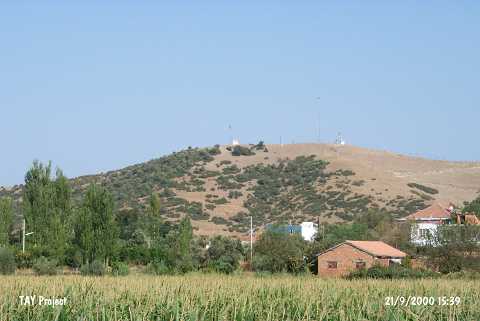 |
|
Type:
|
Mound |
|
Altitude:
|
140 m |
|
Region:
|
Aegean |
|
Province:
|
Aydin |
|
District:
|
Merkez |
|
Village:
|
Dalama |
|
Investigation Method:
|
Survey |
|
Period:
|
|
|
|
|
 |
|
| It is located 1.6 km northeast of Dalama; southeast of the province of Aydin. It lies on a high and large rocky hill to the west of Büyük Menderes River; in the middle of Büyük Menderes Plain. It has been officially proclaimed as a registered site. It is reported to be damaged by illicit diggings and the TV transmitters located on the top. Remains of Roman Period city walls were encountered on the hill. Potsherds dating to the end of EBA and the Iron Age were collected from the surface. It takes place in the registered archaeological sites list prepared by Ministry of Culture and Tourism. |
| Location: |
| Geography and Environment: |
| History: |
| Research and Excavation: |
| Stratigraphy: |
| Small Finds: |
| Remains: |
| Interpretation and Dating: |