|
©The Archaeological Settlements of Turkey - TAY Project
|
|
|
|
|
|
Bektemür Höyük |
|
|
For site maps and drawings please click on the picture...  |
For photographs please click on the photo... 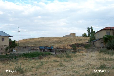 |
|
Type:
|
Mound |
|
Altitude:
|
1080 m |
|
Region:
|
Central Anatolia |
|
Province:
|
Konya |
|
District:
|
Beysehir |
|
Village:
|
Bekdemir |
|
Investigation Method:
|
Survey |
|
Period:
|
|
|
|
|
 |
|
| It locates 100 m southeast of Bekdemir Village; east of Beysehir District of Konya Province. This site; which is also known as Rekdemir Höyük lies by the southeast corner of Beysehir Lake. Potsherds dated to EBA were also found at the site wnhich was discoverd by J. Mellaart in 1952. |
| Location: |
| Geography and Environment: |
| History: |
| Research and Excavation: |
| Stratigraphy: |
| Small Finds: |
| Remains: |
| Interpretation and Dating: |