|
©The Archaeological Settlements of Turkey - TAY Project
|
|
|
|
|
|
Bayram Tepesi |
|
|
For site maps and drawings please click on the picture...  |
For photographs please click on the photo... 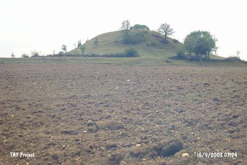 |
|
Type:
|
Mound |
|
Altitude:
|
350 m |
|
Region:
|
Black Sea |
|
Province:
|
Sinop |
|
District:
|
Saraydüzü |
|
Village:
|
Kiziloglan |
|
Investigation Method:
|
Survey |
|
Period:
|
|
|
|
|
 |
|
| It lies 1 km southeast of Saraydüzü District; south of Boyabat; south of Sinop Province. It is located to the north of Embiyeli quarter of Saraydüzü and west-southwest of Bahçeagaçli Village. To the north-northwest of the site flows the Körmençayi Stream and to the south-southeast is the hill known as Çes Tepesi. It was discovered during a survey conducted by Donceel-Voute in the name of the Dutch Archaeological Institute in 1977. Besides EBA; sherds dating from the Iron Age and Middle Age were recovered. It was revisited during a survey conducted by S. Dönmez in 1998. It measures 10 m in height and 9x70 m in dimensions. Only sherds dating from the EBA were collected from the surface according to S. Dönmez. It takes place in the registered archaeological sites list prepared by Ministry of Culture and Tourism. |
| Location: |
| Geography and Environment: |
| History: |
| Research and Excavation: |
| Stratigraphy: |
| Small Finds: |
| Remains: |
| Interpretation and Dating: |