|
©The Archaeological Settlements of Turkey - TAY Project
|
|
|
|
|
|
Bayrakli |
|
|
For site maps and drawings please click on the picture... 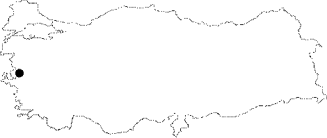 |
For photographs please click on the photo... 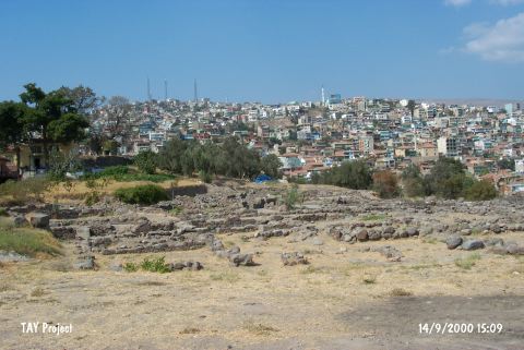 |
|
Type:
|
Mound |
|
Altitude:
|
40 m |
|
Region:
|
Aegean |
|
Province:
|
Izmir |
|
District:
|
Merkez |
|
Village:
|
|
|
Investigation Method:
|
Excavation |
|
Period:
|
EBA II |
|
|
|
 |
|
| Location: It is located inside the metropolis of Izmir on the northeast. It could have been saved from a severe damage only after being announced as a registered site. It is also known as Tepekule. |
| Geography and Environment: It is situated east-northeast of the Izmir Gulf. It is 14 m high. To the west flows the stream of Meles. Today the site is far from the shoreline. However; it is suggested that it used to be on the coast during the settlements with two ports on both sides of an outcrop [Akurgal 1983:fig.1-2]. Eventually; it was abandoned since it was close to the swamp. The rock underneath is 6.4 m high. |
| History: |
| Research and Excavation: The mound was visited during a collaborative survey by the University of Ankara and the British Archaeological Institute in 1948; and chosen as an excavation site being the oldest settlement known in the vicinity of Izmir. The systematic excavations started in 1948 at the site where previously soundings were carried out in 1930's. The first excavations were conducted by J. Cook; J. Brock and E. Akurgal. Later the excavations conducted by E. Akurgal and after him still being excavated by M. Akurgal. The excavation was mainly concerned with the Hellenistic Period layers rather than the prehistoric layers. The place which exists in the Kültepe documents as Tismurna is actually Izmir; when the prefix "Ti" is overseen. Smurna is the name of the settlement at Bayrakli and that is where the name Izmir derives from. |
| Stratigraphy: It was first occupied during Troy I (EBA I-IIa) on a rocky area 3-5 m high from the sea. On top of this layer lie Troy II and Troy VI phases (2nd millennium BC); and on the top; settlements dating from the 7-4th centuries BC [Akurgal 1983:13]. |
| Small Finds: Architecture: In 1949 the trench E aimed at finding the first settlements of the mound yielded three building levels belonging to the prehistoric age. The building level 2 revealed that the walls of the buildings with a superstructure of mudbrick and substructure of stone stand on the bedrock [Akurgal 1950:pl.Ia]. It is stated that the walls and the floors were plastered only in a few thickness [Akurgal 1950:4]. Pottery: It is reported that in the lower levels of Bayrakli; sherds of the plain and decorated ware of Troy I and III were found[Akurgal 1950:3-4]. |
| Remains: |
| Interpretation and Dating: Because the Bayrakli excavations were mainly concerned with revealing the finds of the Eastern Hellenistic Civilization; the prehistoric level finds were never published. Most of the documents related to Western Anatolian Prehistory mention this fact [Easton 1976:154-155]. Although uncertain; D.H. French marked Bayrakli in the distribution map of Kumtepe Ib [French 1961:map in fig.2]. |