|
©The Archaeological Settlements of Turkey - TAY Project
|
|
|
|
|
|
Baskuyu 1 |
|
|
For site maps and drawings please click on the picture... 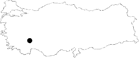 |
For photographs please click on the photo... 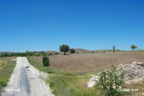 |
|
Type:
|
Mound |
|
Altitude:
|
1170 m |
|
Region:
|
Mediterranean |
|
Province:
|
Burdur |
|
District:
|
Yesilova |
|
Village:
|
Baskuyu |
|
Investigation Method:
|
Survey |
|
Period:
|
Ceramic |
|
|
|
 |
|
| This site lies southwest of the city of Burdur; 13 km east of the town of Yesilova and 1.5 km northeast of the village of Baskuyu. This mound lies immediately west of Akpinar Stream and is bounded by Yarisli Lake to the southwest and the Irla Plain to the southeast; by the plain north of the village of Baskuyu; and by the mountains south and east of this village. It is a flat and broad mound which has been partially destroyed as a result of highway construction. It was discovered in 1982 by M. Özsait. A few painted and multicolored Late Neolithic and Early Chalcolithic sherds were collected. The fragments resemble the red painted; beige slipped sherds as well as the reddish brown ware from Hacilar VI. The fragments found are mostly from small vessels. |
| Location: |
| Geography and Environment: |
| History: |
| Research and Excavation: |
| Stratigraphy: |
| Small Finds: |
| Remains: |
| Interpretation and Dating: |