|
©The Archaeological Settlements of Turkey - TAY Project
|
|
|
|
|
|
Salar Kalesi |
|
|
For site maps and drawings please click on the picture...  |
For photographs please click on the photo... 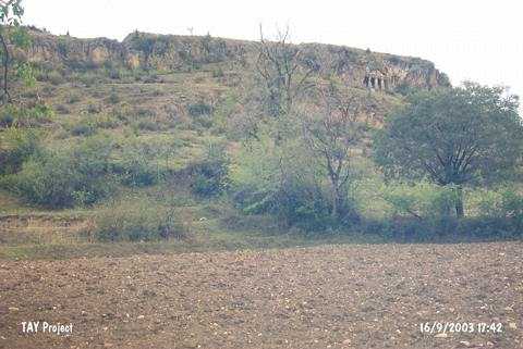 |
|
Type:
|
Slope Settlement |
|
Altitude:
|
405 m |
|
Region:
|
Black Sea |
|
Province:
|
Sinop |
|
District:
|
Boyabat |
|
Village:
|
Salar |
|
Investigation Method:
|
Survey |
|
Period:
|
|
|
|
|
 |
|
| It is located south-southwest of the village of Salar; 15 km west of the district of Boyabat in the province of Sinop and is well-known with the Paphlagonian type rock tomb. Especially the northwestern and western slopes; besides the materials dating to the Hellenistic and Roman periods when the castle was occupied; have yielded EBA ceramics which indicate a settlement in an earlier phase. |
| Location: |
| Geography and Environment: |
| History: |
| Research and Excavation: |
| Stratigraphy: |
| Small Finds: |
| Remains: |
| Interpretation and Dating: |