|
©The Archaeological Settlements of Turkey - TAY Project
|
|
|
|
|
|
Barak |
|
|
For site maps and drawings please click on the picture...  |
For photographs please click on the photo... 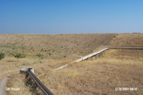 |
|
Type:
|
Habitation Site / Workshop |
|
Altitude:
|
510 m |
|
Region:
|
Southeastern Anatolia |
|
Province:
|
Gaziantep |
|
District:
|
Karkamis |
|
Village:
|
Yurtbagi |
|
Investigation Method:
|
Survey |
|
Period:
|
OP |
|
|
|
 |
|
| Location: This site is southeast of the city of Gaziantep; 1.100 m west of the village of Yurtbagi (Mercihamis); which is north of the town of Barak. It is very close to the Syrian border and lies on either side of the highway which bisects it. |
| Geography and Environment: The exact location and the geographic setting of the site has not been given. The Barak Plain is mostly flat but it also has some slightly rolling terrain. |
| History: |
| Research and Excavation: In the survey conducted by J. Perrot in 1961; many chipped stone tools were found on both sides of the above mentioned highway. The surface collection of the artifacts was not systematic. Perrot does not give the dimensions of this site. H.H. von der Osten also conducted a survey in the area. It takes place in the registered archaeological sites list prepared by Ministry of Culture and Tourism. |
| Stratigraphy: |
| Small Finds: Even though Perrot mentions that he found a large number of Moustérien flakes; he does not provide any information on their quantity or frequency. There is also no typological information on the chipped stone artifacts [Perrot 1962:fig. 9]. Von der Osten reports finding a chipped stone tool near the Syrian border [von der Osten 1937b:405]. Unfortunately because neither surveyor is explicit in their descriptions of the site's location; it is not certain whether they are referring to the same site. |
| Remains: |
| Interpretation and Dating: |