|
©The Archaeological Settlements of Turkey - TAY Project
|
|
|
|
|
|
Kusnafak Kalesi - Ambarkayasi |
|
|
For site maps and drawings please click on the picture...  |
For photographs please click on the photo... 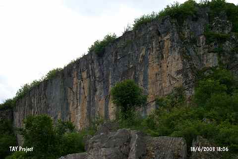 |
|
Type:
|
Slope Settlement |
|
Altitude:
|
590 m |
|
Region:
|
Black Sea |
|
Province:
|
Ordu |
|
District:
|
Kumru |
|
Village:
|
Akçadere |
|
Investigation Method:
|
Survey |
|
Period:
|
|
|
|
|
 |
|
| 1 km northeast of the village of Akçadere in the Kumru Province of Ordu District; is the high rocky area. To the west of this area is Ambarkayasi and to the north is the steep rocky cliff named Kusnafak Kalesi. They were separated from the bedrock because of the earthquake and landslide; and torn to pieces like islands. Pottery sherds belonging to an EBA settlement were encountered over and around Ambarkayasi; and remains of a wall constructed with mortar made of brick dust and lime were found in Kusnafak Kalesi. |
| Location: |
| Geography and Environment: |
| History: |
| Research and Excavation: |
| Stratigraphy: |
| Small Finds: |
| Remains: |
| Interpretation and Dating: |