|
©The Archaeological Settlements of Turkey - TAY Project
|
|
|
|
|
|
Karaagaç Höyük |
|
|
For site maps and drawings please click on the picture...  |
For photographs please click on the photo... 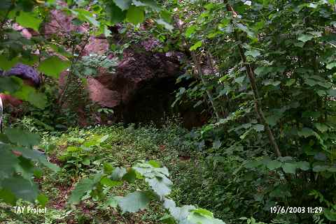 |
|
Type:
|
Mound |
|
Altitude:
|
230 m |
|
Region:
|
Black Sea |
|
Province:
|
Ordu |
|
District:
|
Kumru |
|
Village:
|
Karaagaç |
|
Investigation Method:
|
Survey |
|
Period:
|
|
|
|
|
 |
|
| It lies in the location known as Kayadibi; in front of the mountainous ridge immediately south of the Karaagaç-Kumru road; 2 km southwest of the village of Karaagaç which is 9 km northeast of the district of Kumru in the province of Ordu. EBA pottery sherds were encountered in the soil in front of the 3 m deep illicit pit; dug in front of the Hellenistic-Roman rock tomb; and in the areas declining towards the road. |
| Location: |
| Geography and Environment: |
| History: |
| Research and Excavation: |
| Stratigraphy: |
| Small Finds: |
| Remains: |
| Interpretation and Dating: |