|
©The Archaeological Settlements of Turkey - TAY Project
|
|
|
|
|
|
Hidirlik - Akkaya Tepesi |
|
|
For site maps and drawings please click on the picture...  |
For photographs please click on the photo... 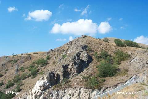 |
|
Type:
|
Upland Settlement |
|
Altitude:
|
925 m |
|
Region:
|
Black Sea |
|
Province:
|
Amasya |
|
District:
|
Merzifon |
|
Village:
|
Hirka |
|
Investigation Method:
|
Survey |
|
Period:
|
|
|
|
|
 |
|
| It lies on a natural hill immediately south of the Hirka Köyü Dam; 3 km north of the district of Merzifon in the province of Amasya. It measures about 100 m in diameter and was destructed by erosion and illicit digging. Pottery sherds belonging to EBA and Iron Age settlements were found on the surface. |
| Location: |
| Geography and Environment: |
| History: |
| Research and Excavation: |
| Stratigraphy: |
| Small Finds: |
| Remains: |
| Interpretation and Dating: |