|
©The Archaeological Settlements of Turkey - TAY Project
|
|
|
|
|
|
Balikavi |
|
|
For site maps and drawings please click on the picture...  |
For photographs please click on the photo... 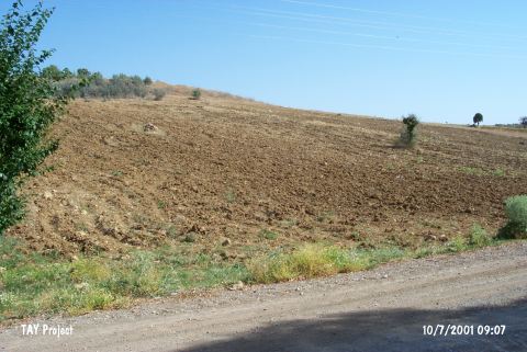 |
|
Type:
|
Flat Settlement |
|
Altitude:
|
1050 m |
|
Region:
|
Central Anatolia |
|
Province:
|
Konya |
|
District:
|
Ahirli |
|
Village:
|
Baliklava |
|
Investigation Method:
|
Survey |
|
Period:
|
Ceramic |
|
|
|
 |
|
| Location: This site lies southwest of the city of Konya; 16.5 km north-northwest of the town of Bozkir; 5-6 km east of the Sugla Lake; close (and probably west of) to the village of Balikavi (also known as Balikhavi). |
| Geography and Environment: No information is provided on the location of this site; which lies by Çarsamba Stream. Çarsamba Stream forms from the joining of the Kurukafa water channel; which originates in the north; and another water channel; which originates at Sugla (Karaviran) Lake. The modern settlements and farms in the region supply their water from Çarsamba Stream. |
| History: |
| Research and Excavation: The site was discovered in 1963 during the surface survey conducted by Solecki. |
| Stratigraphy: |
| Small Finds: Pottery: Solecki's survey report of Neolithic sites in"Göller Bölgesi" literally "the Lakes Region" has not been published. Although we do not have detailed information on the ceramics; it is known that the collected sherds were Neolithic in date and that they included examples of dark burnished ware. Chipped Stone: The chipped stone finds include obsidian tools and debitage products. |
| Remains: |
| Interpretation and Dating: Solecki assigns this site to the Neolithic although the information provided is limited. In ASPRO; the site is placed in the sixth cultural level and is dated to 7;600-7;000 BP [Hours et al. 1994:72]. |