|
©The Archaeological Settlements of Turkey - TAY Project
|
|
|
|
|
|
Agatepe |
|
|
For site maps and drawings please click on the picture...  |
For photographs please click on the photo... 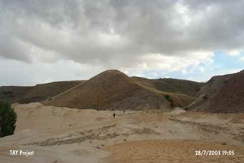 |
|
Type:
|
Mound |
|
Altitude:
|
1280 m |
|
Region:
|
Central Anatolia |
|
Province:
|
Sivas |
|
District:
|
Merkez |
|
Village:
|
Budakli |
|
Investigation Method:
|
Survey |
|
Period:
|
|
|
|
|
 |
|
| It is lies south of Taslidere passageway; 500 m west of Budakli village of Merkez District of Sivas. The site is 50-60 m in diameter and 25-30 m in height; its north foot is damaged by a road made in 1972. This Chalcolithic and EBA settlement approximately 1 hectare was discovered by T. Ökse in 1999. It takes place in the registered archaeological sites list prepared by Ministry of Culture and Tourism. |
| Location: |
| Geography and Environment: |
| History: |
| Research and Excavation: |
| Stratigraphy: |
| Small Finds: |
| Remains: |
| Interpretation and Dating: |