|
©The Archaeological Settlements of Turkey - TAY Project
|
|
|
|
|
|
Kuletepe / Asartepe |
|
|
For site maps and drawings please click on the picture...  |
For photographs please click on the photo... 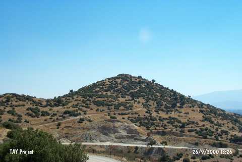 |
|
Type:
|
Mound |
|
Altitude:
|
50 m |
|
Region:
|
Aegean |
|
Province:
|
Aydin |
|
District:
|
Çine |
|
Village:
|
Altinova |
|
Investigation Method:
|
Survey |
|
Period:
|
|
|
|
|
 |
|
| It is the hill also knows as Asartepe to the west of Topçam Dam; north of the village of Altinova; in the district of Çine southeast of the province of Aydin. On its northwestern skirt are sand quarries. It was discovered by E. Akdeniz during the survey of Büyük Menderes Plain in 1995. On the granite layer on this hill is a Byzantine castle. Potsherds dating to the classical periods were encountered outside the castle. Sherds belonging to the end of EBA were collected from the slope. It takes place in the registered archaeological sites list prepared by Ministry of Culture and Tourism. |
| Location: |
| Geography and Environment: |
| History: |
| Research and Excavation: |
| Stratigraphy: |
| Small Finds: |
| Remains: |
| Interpretation and Dating: |