|
©The Archaeological Settlements of Turkey - TAY Project
|
|
|
|
|
|
Altiagaç / Kirlik Mevkii |
|
|
For site maps and drawings please click on the picture...  |
For photographs please click on the photo... 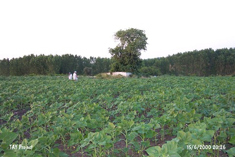 |
|
Type:
|
Flat Settlement |
|
Altitude:
|
40 m |
|
Region:
|
Marmara |
|
Province:
|
Edirne |
|
District:
|
Meriç |
|
Village:
|
Büyük Altiagaç |
|
Investigation Method:
|
Survey |
|
Period:
|
Ceramic |
|
|
|
 |
|
| The site is located on the road to Küçük Altiagaç village; 1 km west of Büyük Altiagaç village; which is about 8 km south of Meriç district in Edirne province. The site is located in the middle of a plain area; immediately west of Bostandere stream which flows in the north-south direction. At a point close to the middle of the sunflower field; there is tomb with a plane tree on it. The settlement is believed to be continuing to the bank of the stream on the east. In 1992; a surface collection was conducted by a team under the directorship of M. Özdogan and in 1997 the site was researched again during the surveys conducted in the region by B. Erdogu. The site has yielded finds; which are accepted to be contemporary with Chalcolithic and the materials from Asagi Pinar 6 and Karanova in the Balkans. Numerous ceramic sherds; bones; seashells and pebbles were seen on the surface. |
| Location: |
| Geography and Environment: |
| History: |
| Research and Excavation: |
| Stratigraphy: |
| Small Finds: |
| Remains: |
| Interpretation and Dating: |