|
©The Archaeological Settlements of Turkey - TAY Project
|
|
|
|
|
|
Ziraat Tepesi |
|
|
For site maps and drawings please click on the picture...  |
For photographs please click on the photo... 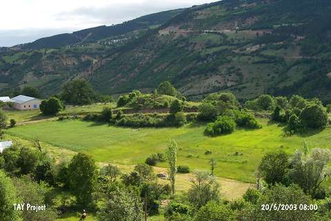 |
|
Type:
|
Mound |
|
Altitude:
|
1230 m |
|
Region:
|
Black Sea |
|
Province:
|
Ordu |
|
District:
|
Mesudiye |
|
Village:
|
Çardakli |
|
Investigation Method:
|
Survey |
|
Period:
|
EBA I |
|
|
|
 |
|
| It is located in the cemetery of Ertürk family; at Ziraat Mevkii; south of the Çukur Quarter; 1 km southeast of Türkköy; 12 km southwest of Mesudiye District; south of Ordu Province. It was discovered during the 1991 Ordu-Mesudiye Survey conducted by M. Özsait. All pottery collected from the surface belongs to the EBA. Some vessels mostly with flat base and simple profile have incised-channel decorations and knobbed lugs. |
| Location: |
| Geography and Environment: |
| History: |
| Research and Excavation: |
| Stratigraphy: |
| Small Finds: |
| Remains: |
| Interpretation and Dating: |